Area Overview for OX6 7GN
Photos of OX6 7GN

Area Information
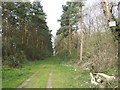
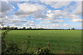
Living in OX6 7GN means residing within a small, tightly knit residential cluster characterised by low density and a quiet atmosphere. The area covers a specific postcode zone where approximately 1,100 people make their home. With a population density of just 47 people per square kilometre, this neighbourhood offers residents a peaceful environment that stands apart from more crowded urban centres. The layout supports a slower pace of life, ideal for those seeking a retreat from city noise while maintaining access to the wider regional network. As one of the more secluded postcodes in the OX6 sector, it attracts individuals who prioritise space and tranquility over immediate proximity to city centre thrills. Daily life here focuses on the rhythm of the home rather than the bustle of high streets. You can expect a residential focus where green spaces and personal yards dominate the streetscape. This makes OX6 7GN a compelling choice for someone who values a defined, manageable community footprint. The area functions as a self-contained pocket of residential living within the broader Danes Farm region.
- Area Type
- Postcode
- Area Size
- Not available
- Population
- 1100
- Population Density
- 47 people/km²
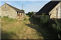
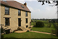
The property market in OX6 7GN is defined by a strong focus on family homes rather than urban apartments or multi-storey buildings. Houses constitute the primary form of accommodation, catering to households that require gardens and space. With 70 per cent of residents being homeowners, the area functions largely as an owner-occupied market. This high level of ownership implies that properties often stay within local families for generations, creating a homogeneous housing stock. Buyers looking for apartments or purpose-built flats will find limited supply within this specific postcode, as the architectural style favours traditional housing. The presence of established homes suggests that new builds are rare, meaning purchasers often buy existing character properties. Mortgages and shared ownership schemes may be relevant for the 30 per cent of residents who do not own their homes. The market reflects a demand for security and longevity, mirroring the broader demographic trends of the area. Sellers in OX6 7GN typically target families seeking a permanent base rather than investors seeking quick turnover.
House Prices in OX6 7GN
No properties found in this postcode.
Energy Efficiency in OX6 7GN
Residents of OX6 7GN enjoy convenient access to essential retail and transport hubs within practical reach. Five major retail outlets are located nearby, including Tesco Southwold, Co-op Barberry, and Tesco Bicester. These supermarkets provide daily necessities, groceries, and household essentials without requiring long journeys into the city centre. Two railway stations serve the wider neighbourhood, offering connections via Bicester North Railway Station and Bicester Village Railway Station. These stations unlock access to Oxford and London, facilitating commutes for those working in major regional employment centres. The availability of these specific venues transforms OX6 7GN from an isolated enclave into a connected residential hub. You can buy fresh bread in the morning and board a train for work in the afternoon using the same facilities. This blend of local convenience and regional connectivity defines the practical lifestyle for anyone living in this postcode.
Amenities
Schools
Families considering OX6 7GN have access to established educational facilities nearby. Fringford Church of England Primary School stands as the notable primary option within reach. The school holds a 'good' Ofsted rating, signalling a standard of education that meets government expectations for teaching quality and student welfare. This single nomination suggests a local hierarchy where primary education is well-covered, though secondary options are not listed in the immediate vicinity of this specific postcode. The 'good' rating for Fringford provides reassurance for parents prioritising state education for their children living in OX6 7GN. While the data highlights one primary institution, families relying on this area must look beyond immediate boundaries for comprehensive schooling options, including secondary education. The presence of a rated primary school indicates that the local education catchment area folds into this residential zone. Prospective homebuyers should verify school boundaries to ensure their future property falls within the correct attendance zones for secondary progression.
| Rank | School | Type | Entry gender | Ages |
|---|---|---|---|---|
| 1 | Fringford Church of England Primary School | primary | N/A | N/A |
Explore more schools in this area
Go to Schools tabDemographics
The community in OX6 7GN reflects a mature demographic profile with a median age of 47 years. Most residents fall into the adult bracket spanning 30 to 64 years, indicating a neighbourhood populated by established families and career professionals. This age distribution suggests a stable environment where residents are likely to have settled roots and long-term local connections. Home ownership is highly prevalent, with 70 per cent of households owning their property outright or via mortgage. This high ownership rate points to a permanent community rather than a transient rental market. Houses dominate the accommodation type, providing detached or semi-detached living rather than high-density flats or apartments. The predominant ethnic group is White, which aligns with typical patterns in many suburban clusters outside major metropolitan centres. There are no indicators of large-scale deprivation affecting this area; instead, the stability of ownership and age suggests a well-established settlement. Residents here typically contribute to a culturally consistent community where long-term neighbours support one another.
Household Size
Accommodation Type
Tenure
Ethnic Group
Religion
Household Composition
Age
Household Deprivation
NS-SEC
Explore more demographic insights in this area
Go to Demographics tabPlanning
Planning Constraints
- Flood RiskPremium
- Ramsar Wetland SitesPremium
- Area of Outstanding Natural BeautyPremium
- Protected Nature ReservePremium
- Protected WoodlandPremium