Area Overview for OX6 4DL
Photos of OX6 4DL


Area Information
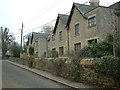
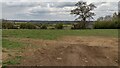
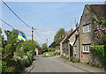
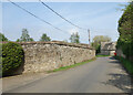
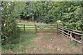
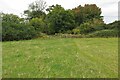
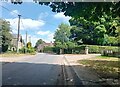
Living in OX6 4DL means choosing a specific residential cluster defined by its quiet character and stable community. This postcode covers a small area with a population of 1453 residents. You will find a living environment marked by low density rather than urban hustle. The population density stands at just 77 people per square kilometre, creating a neighbourhood where space prevails. Daily life here revolved around proximity to rural elements rather than city centres. Given the scale of the area, residents often rely on nearby towns for significant shopping or entertainment. The layout supports a pace of life that many seek when moving away from overcrowded urban centres. You can expect a settled atmosphere where neighbours likely know one another. This quiet setting appeals to those prioritising space and tranquillity over urban connectivity. The location serves as a practical base for commuters accessing wider transport hubs further away. Buying a home here offers a distinct break from the noise and congestion of larger settlements. The area functions as a solid residential sector within the broader Oxfordshire landscape. Its small size ensures that changes to the local character are slow and manageable for you.
- Area Type
- Postcode
- Area Size
- Not available
- Population
- 1453
- Population Density
- 77 people/km²
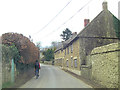
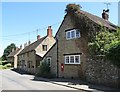
The property market in OX6 4DL is characterised by ownership rather than renting. eighty percent of households own their homes, meaning the rental sector plays a minor role here. Houses constitute the main form of accommodation available. You are unlikely to encounter trendy flats or tower blocks in this postcode. The housing stock reflects a desire for traditional living spaces suited to local needs. Buyers looking at this area should expect to find detached or semi-detached properties typical of the region. The high ownership rate implies that properties often change hands slowly. This lack of turnover can make finding a specific type of home take longer than in more dynamic cities. When viewing homes in OX6 4DL, focus on the condition of the fabric and garden space. Local real estate will feature standard family homes rather than speculative developments. The market absorbs demand from people seeking stability and space. If you are buying, verify that the specific property meets your needs for space and layout. The lack of flats makes OX6 4DL less suitable for small city dwellers looking to downsize. However, it remains a practical choice for those wanting a home in a quiet, lower-density setting. Your search should be localised given the small catchment area of this specific cluster.
House Prices in OX6 4DL
No properties found in this postcode.
Energy Efficiency in OX6 4DL
Your daily life in OX6 4DL involves accessing specific amenities located just outside the immediate cluster. Five local shops provide essential retail needs. You can visit the Co-op in Deddington for general shopping. Sainsburys in Upper Heyford offers another supermarket option for your weekly provisions. Asda in Baynards provides a larger format store for bulk buying. These three chains ensure you do not need to travel far for basic goods. Three railway stations also serve as key transport nodes. Heyford Railway Station, Kings Sutton Railway Station, and Tackley Railway Station sit within practical reach of your doorstep. You can incorporate train travel into your weekly routine without significant disruption. While specific leisure venues like cinemas or arcades are not listed in the data, retail and transport cover the fundamental needs of daily living. The character of this lifestyle is defined by local necessity rather than urban spectacle. You will drive to these nearby towns for social activities or larger entertainment. This arrangement works well for residents unwilling to spend much time in crowded city centres. The convenience of Co-op, Sainsburys, and Asda means you can manage household logistics efficiently. Your weekend might involve a trip to one of the railway stations for a relaxed commute. The layout supports a self-sufficient rural or semi-rural existence without constant reliance on digital entertainment hubs.
Amenities
Schools
Families living in OX6 4DL have access to two primary institutions within close proximity. Dr Radcliffe's Church of England School serves as a primary option for younger children. Nearby, you will find Dr Radcliffe's Church of England Primary School, which holds a 'good' Ofsted rating. This official rating confirms the school meets expected standards of education and behaviour. The presence of a Church of England school indicates a specific religious ethos for families seeking that environment. Both institutions cater to the primary education phase, but detailed information regarding secondary schools is not included in the current data. You must research options beyond OX6 4DL if your children require secondary education, as none are listed here. The availability of two primary schools with similar naming suggests a coordinated local education structure. For you as a parent, the 'good' rating of the primary school provides reassurance regarding academic quality. The choice between the two buildings may depend on your specific religious preferences or the nearest street entrance. Limited data on secondary provision means you must look to broader Oxfordshire for comprehensive results. Rely on the Ofsted status of the primary schools as your starting point for educational quality.
| Rank | School | Type | Entry gender | Ages |
|---|
Explore more schools in this area
Go to Schools tabDemographics
The community in OX6 4DL is dominated by adults, with 80% of the population falling between the ages of 30 and 64 years. This age range represents the most common demographic, indicating a household composed of working families or retirees seeking stability. The median age for residents is 47 years, confirming that this is not a youthful student village but a mature settlement. Home ownership is exceptionally high, with 80% of households owning their property outright. This figure suggests long-term stability rather than a transient rental market. Houses form the primary accommodation type throughout the postcode area. You will find very few flats or Purpose-built blocks within OX6 4DL itself. The predominant ethnic group is White, which aligns with the demographic profile of many rural and suburban Oxfordshire locations. Deprivation levels are not detailed in the provided statistics, so you cannot make claims about economic hardship or disadvantage. Instead, the high home ownership rate signals financial security for the majority of owners. This demographic snapshot paints a picture of a firmly established community where individuals have put down roots. Families with children and couples approaching retirement find the environment conducive to their specific lifestyles.
Household Size
Accommodation Type
Tenure
Ethnic Group
Religion
Household Composition
Age
Household Deprivation
NS-SEC
Explore more demographic insights in this area
Go to Demographics tabPlanning
Planning Constraints
- Flood RiskPremium
- Ramsar Wetland SitesPremium
- Area of Outstanding Natural BeautyPremium
- Protected Nature ReservePremium
- Protected WoodlandPremium