Area Overview for OX5 2SF
Photos of OX5 2SF
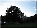
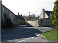
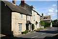
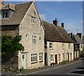
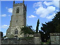

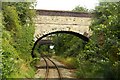
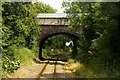
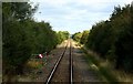
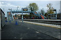
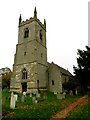
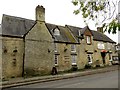
60 photos from this area
Area Information
Key information about the OX5 2SF including its size, population, and administrative classification.
- Area Type
- Postcode
- Area Size
- 1.5 hectares
- Population
- 1227
- Population Density
- 80 people/km²
House Prices in OX5 2SF
21
Properties
£659,325
Average Sold Price
£145,000
Lowest Price
£1,720,000
Highest Price
Showing 21 properties
| Address | Type | Beds | Baths | Last Sale Price | Last Sale Date | |
|---|---|---|---|---|---|---|
| Lower House, Middle Street, Islip, OX5 2SF | Detached | 5 | 3 | £1,720,000 | Aug 2025 | |
| Cobweb Cottage, 2 Middle Street, Islip, OX5 2SF | Cottage | 2 | 1 | £350,000 | Oct 2023 | |
| Hill House, Middle Street, Islip, OX5 2SF | Bungalow | 3 | 1 | £950,000 | Jul 2023 | |
| The Old Bakehouse, Middle Street, Islip, OX5 2SF | house | 2 | - | £570,000 | Aug 2022 | |
| Greystones, Middle Street, Islip, OX5 2SF | Detached | 4 | 3 | £890,000 | Mar 2021 | |
| Wisteria Cottage, 4 Middle Street, Islip, OX5 2SF | Terraced | 2 | 1 | £412,500 | Feb 2020 | |
| Great Barn, Middle Street, Islip, OX5 2SF | house | - | - | £1,250,000 | May 2016 | |
| Eversleigh, Middle Street, Islip, OX5 2SF | Detached | 3 | - | £800,000 | Jun 2015 | |
| St Nicholas Cottage, Middle Street, Islip, OX5 2SF | Cottage | 3 | - | £370,000 | Sep 2013 | |
| Bannisters, Middle Street, Islip, OX5 2SF | house | - | - | £713,019 | Dec 2009 |
Page 1 of 3
Energy Efficiency in OX5 2SF
Amenities
Schools
| Rank | School | Type | Entry gender | Ages |
|---|
Explore more schools in this area
Go to Schools tabDemographics
Household Size
Two person
most common
Accommodation Type
Houses
most common
Tenure
82
majority
Ethnic Group
White
most common
Religion
N/A
most common
Household Composition
N/A
most common
Age
47
median
Adults (30-64 years)
most common
Household Deprivation
N/A
with no deprivation
NS-SEC
52
in Lower managerial occupations
Explore more demographic insights in this area
Go to Demographics tabPlanning
Planning Constraints
- Flood RiskPremium
- Ramsar Wetland SitesPremium
- Area of Outstanding Natural BeautyPremium
- Protected Nature ReservePremium
- Protected WoodlandPremium