Area Overview for OX5 2NZ
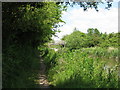
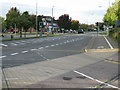
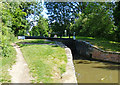
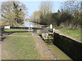
Photos of OX5 2NZ


Area Information
OX5 2NZ is a specific postcode area covering a small residential cluster in Oxfordshire. The land spans 3648 square metres and supports a population of 1886 people. With a population density of 129 people per square kilometre, this zone maintains a relatively spread-out feel. Living in OX5 2NZ offers a quiet environment defined by its sparse footprint. The area functions as a residential hub rather than a commercial centre, focusing entirely on housing needs. You will find a community that values space and tranquility over urban density. The sheer size of the cluster is compact compared to wider villages. This specific postcode represents a manageable piece of the broader Oxfordshire landscape. Daily life here revolves around proximity to local services and established transport links. The area does not boast high-rise developments or industrial zones. Instead, it offers a focused living experience for those seeking a home in a defined, smaller-scale location. You occupy a distinct residential patch that balances isolation with necessary connectivity.
- Area Type
- Postcode
- Area Size
- 3648 m²
- Population
- 1886
- Population Density
- 129 people/km²
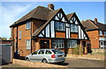
The property market in OX5 2NZ is defined by a predominantly owner-occupied structure. With 74% home ownership, the area serves primarily as a location for residents to buy rather than rent. The accommodation type data confirms that houses dominate the housing stock. This means you will encounter detached or semi-detached buildings rather than flats or apartments. Buying into OX5 2NZ often involves acquiring an independent property with its own grounds or private space. The high ownership rate suggests that the local economy supports significant investment in residential real estate. You are unlikely to find large sections of social housing or collective living arrangements. The market reflects a preference for permanent settlement over temporary accommodation. If you are looking for a rented flat or maisonette, you will find few options within this specific postcode. The housing should consists of single-family units designed for nuclear or extended families. Transaction volumes may be steady rather than explosive given the size of the cluster. Potential buyers must expect the process to involve competing with owners who have deep roots in the area.
House Prices in OX5 2NZ
Showing 5 properties
| Address | Type | Beds | Baths | Last Sale Price | Last Sale Date | |
|---|---|---|---|---|---|---|
| 233 Oxford Road, Kidlington, OX5 2NZ | Semi-detached | 3 | 1 | £475,000 | Sep 2023 | |
| 231 Oxford Road, Kidlington, OX5 2NZ | Semi-detached | 3 | 1 | £420,000 | Mar 2021 | |
| 225 Oxford Road, Kidlington, OX5 2NZ | Detached | 3 | 1 | £423,000 | Dec 2020 | |
| 229 Oxford Road, Kidlington, OX5 2NZ | Semi-detached | - | - | - | - | |
| 227 Oxford Road, Kidlington, OX5 2NZ | Semi-detached | - | - | - | - |
Energy Efficiency in OX5 2NZ
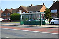
Amenities within practical reach of OX5 2NZ offer daily convenience without requiring long commutes. The retail sector includes five nearby stores, with Sainsburys Kidlington, Co-op Oxford, and Co-op Kidlington being notable options. These supermarkets handle essential grocery shopping and basic household needs efficiently. You can purchase food staples or daily essentials without travelling far into the city. For rail travel, five stations lie within easy reach. Oxford Parkway Railway Station, Islip Railway Station, and Hanborough Railway Station provide access to wider networks beyond the local cluster. These rail links connect you to major cities and regional hubs potentially across England. Two airports also sit within practical driving distance. London Oxford Airport and Oxford (Kidlington) Airport handle general and business aviation traffic respectively. While not residential, these facilities contribute to the regional accessibility profile. You benefit from proximity to national air transport hubs. The mixing of retail and rail options creates a balanced lifestyle ecosystem. Residents enjoy the ease of grabbing dinner at a nearby Co-op or catching a train from Islip. This convenience reduces the need to plan complex daily commutes for routine errands.
Amenities
Schools
Education facilities near OX5 2NZ cater to early years through primary schooling. Edward Feild Nursery School serves the youngest residents before they begin primary education. Edward Feild Primary School holds a good Ofsted rating, assuring quality teaching standards for early school years. Parents seeking primary education can choose between Edward Feild Primary School or Gosford Hill Primary School. Gosford Hill School operates as both a primary academy and holds a good Ofsted rating. This dual status reflects a committed approach to educational standards within the academy chain. You have access to two academies and one primary school with a good rating directly on the list. The presence of an academy indicates a government-funded institution with greater autonomy over its curriculum. Having both rated and unrated primary options allows for selective choice based on specific preferences. The mix of nursery and primary provision ensures comprehensive early learning coverage without the need to travel far. Families with children will find a direct support network within the immediate vicinity of OX5 2NZ. The availability of a nursery alongside primary schools simplifies the daily drop-off routine for parents.
| Rank | School | Type | Entry gender | Ages |
|---|
Explore more schools in this area
Go to Schools tabDemographics
The community in OX5 2NZ reflects a mature demographic profile. The median age is 47 years, placing the neighbourhood firmly within the adult demographic. Most residents fall into the 30-64 year age range, indicating a stable population of working-age adults. This age distribution suggests a family-oriented or established professional environment. Home ownership stands at 74%, meaning the majority of households own their properties outright. This high rate of ownership typically indicates long-term residents rather than transient tenants. The predominant ethnic group is White, which aligns with the established character of the region. Houses form the primary accommodation type, confirming that the area caters to traditional domestic living. There are no high-density blocks or shared housing schemes present. You can expect a neighbourhood where neighbours often know each other through decades of residence. The age profile supports a steady demand for single-family homes. Younger families or older retirees without dependents make up the smaller parts of the population. The data points to a settled, established community with clear economic stability.
Household Size
Accommodation Type
Tenure
Ethnic Group
Religion
Household Composition
Age
Household Deprivation
NS-SEC
Explore more demographic insights in this area
Go to Demographics tabPlanning
Planning Constraints
- Flood RiskPremium
- Ramsar Wetland SitesPremium
- Area of Outstanding Natural BeautyPremium
- Protected Nature ReservePremium
- Protected WoodlandPremium