Area Overview for OX5 2EY
Photos of OX5 2EY

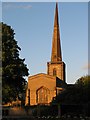
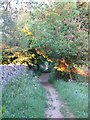
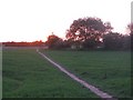
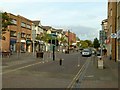

81 photos from this area
Area Information
Key information about the OX5 2EY including its size, population, and administrative classification.
- Area Type
- Postcode
- Area Size
- 1.0 hectares
- Population
- 1584
- Population Density
- 4345 people/km²
House Prices in OX5 2EY
23
Properties
£358,625
Average Sold Price
£175,000
Lowest Price
£535,000
Highest Price
Showing 23 properties
| Address | Type | Beds | Baths | Last Sale Price | Last Sale Date | |
|---|---|---|---|---|---|---|
| 69 Green Road, Kidlington, OX5 2EY | Semi-detached | 3 | 2 | £440,000 | Jul 2025 | |
| 62 Green Road, Kidlington, OX5 2EY | Semi-detached | 4 | 2 | £495,000 | Jan 2025 | |
| 60 Green Road, Kidlington, OX5 2EY | Semi-detached | 4 | 2 | £535,000 | Oct 2024 | |
| 72 Green Road, Kidlington, OX5 2EY | Semi-detached | 2 | 1 | £280,000 | Mar 2023 | |
| 68 Green Road, Kidlington, OX5 2EY | Maisonette | - | - | £263,000 | Nov 2021 | |
| 66 Green Road, Kidlington, OX5 2EY | Semi-detached | 2 | 1 | £251,000 | Sep 2019 | |
| 58 Green Road, Kidlington, OX5 2EY | Semi-detached | 4 | 3 | £430,000 | Sep 2018 | |
| 76 Green Road, Kidlington, OX5 2EY | Semi-detached | 2 | - | £175,000 | Nov 2013 | |
| 68B Green Road, Kidlington, OX5 2EY | Flat | - | - | - | - | |
| 68A Green Road, Kidlington, OX5 2EY | Maisonette | - | - | - | - |
Page 1 of 3
Energy Efficiency in OX5 2EY
Amenities
Schools
| Rank | School | Type | Entry gender | Ages |
|---|
Explore more schools in this area
Go to Schools tabDemographics
Household Size
Two person
most common
Accommodation Type
Houses
most common
Tenure
70
majority
Ethnic Group
White
most common
Religion
N/A
most common
Household Composition
N/A
most common
Age
47
median
Adults (30-64 years)
most common
Household Deprivation
N/A
with no deprivation
NS-SEC
40
in Lower managerial occupations
Explore more demographic insights in this area
Go to Demographics tabPlanning
Planning Constraints
- Flood RiskPremium
- Ramsar Wetland SitesPremium
- Area of Outstanding Natural BeautyPremium
- Protected Nature ReservePremium
- Protected WoodlandPremium