Area Overview for OX5 2EE
Photos of OX5 2EE
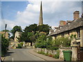
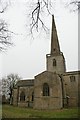


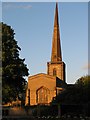
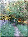
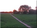
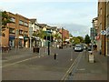
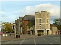
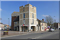

81 photos from this area
Area Information
Key information about the OX5 2EE including its size, population, and administrative classification.
- Area Type
- Postcode
- Area Size
- 6.9 hectares
- Population
- 1366
- Population Density
- 947 people/km²
House Prices in OX5 2EE
48
Properties
£573,894
Average Sold Price
£163,000
Lowest Price
£1,910,000
Highest Price
Showing 48 properties
| Address | Type | Beds | Baths | Last Sale Price | Last Sale Date | |
|---|---|---|---|---|---|---|
| 69 Mill Street, Kidlington, OX5 2EE | Cottage | 2 | - | £292,500 | Jun 2021 | |
| The Vicarage, 39 Mill Street, Kidlington, OX5 2EE | house | - | - | £1,910,000 | Feb 2019 | |
| 63 Mill Street, Kidlington, OX5 2EE | Cottage | 2 | - | £300,000 | Jan 2019 | |
| 1 Mill Street, Kidlington, OX5 2EE | Detached | 2 | 1 | £560,000 | Jul 2018 | |
| 103 Mill Street, Kidlington, OX5 2EE | Detached | 4 | 1 | £580,000 | Sep 2017 | |
| 71 Mill Street, Kidlington, OX5 2EE | Bungalow | 2 | 1 | £499,995 | Jun 2016 | |
| 47 Mill Street, Kidlington, OX5 2EE | house | - | - | £1,200,000 | Aug 2015 | |
| 61 Mill Street, Kidlington, OX5 2EE | Detached | 5 | 4 | £640,000 | May 2014 | |
| 53 Mill Street, Kidlington, OX5 2EE | Bungalow | 2 | - | £305,000 | Nov 2012 | |
| 107 Mill Street, Kidlington, OX5 2EE | Detached | 4 | 3 | £430,000 | Jul 2010 |
Page 1 of 5
Energy Efficiency in OX5 2EE
Amenities
Schools
| Rank | School | Type | Entry gender | Ages |
|---|
Explore more schools in this area
Go to Schools tabDemographics
Household Size
Two person
most common
Accommodation Type
Houses
most common
Tenure
83
majority
Ethnic Group
White
most common
Religion
N/A
most common
Household Composition
N/A
most common
Age
47
median
Elderly (65+ years)
most common
Household Deprivation
N/A
with no deprivation
NS-SEC
50
in Lower managerial occupations
Explore more demographic insights in this area
Go to Demographics tabPlanning
Planning Constraints
- Flood RiskPremium
- Ramsar Wetland SitesPremium
- Area of Outstanding Natural BeautyPremium
- Protected Nature ReservePremium
- Protected WoodlandPremium