Area Overview for OX5 2DS
Photos of OX5 2DS
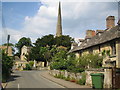
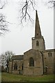
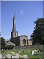
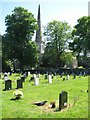
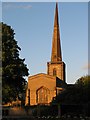
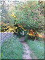
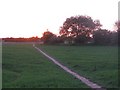
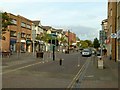
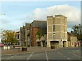
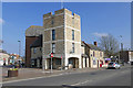
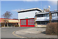
81 photos from this area
Area Information
Key information about the OX5 2DS including its size, population, and administrative classification.
- Area Type
- Postcode
- Area Size
- 1.3 hectares
- Population
- 1584
- Population Density
- 4345 people/km²
House Prices in OX5 2DS
21
Properties
£430,421
Average Sold Price
£200,000
Lowest Price
£850,000
Highest Price
Showing 21 properties
| Address | Type | Beds | Baths | Last Sale Price | Last Sale Date | |
|---|---|---|---|---|---|---|
| 94 High Street, Kidlington, OX5 2DS | Detached | 4 | 3 | £850,000 | Jan 2023 | |
| 108 High Street, Kidlington, OX5 2DS | house | - | - | £425,000 | Oct 2021 | |
| 103 High Street, Kidlington, OX5 2DS | house | - | - | £513,000 | Apr 2021 | |
| 82 High Street, Kidlington, OX5 2DS | Detached | 4 | 2 | £410,000 | Jul 2020 | |
| 92 High Street, Kidlington, OX5 2DS | Bungalow | 4 | 2 | £559,556 | Jun 2017 | |
| 102 High Street, Kidlington, OX5 2DS | Semi-detached | 3 | 1 | £425,000 | Jan 2016 | |
| 113 High Street, Kidlington, OX5 2DS | Terraced | 4 | - | £600,000 | Sep 2013 | |
| 111 High Street, Kidlington, OX5 2DS | house | - | - | £302,500 | Feb 2013 | |
| 106 High Street, Kidlington, OX5 2DS | house | - | - | £295,000 | Dec 2006 | |
| 104 High Street, Kidlington, OX5 2DS | Semi-detached | - | - | £210,000 | Feb 2004 |
Page 1 of 3
Energy Efficiency in OX5 2DS
Amenities
Schools
| Rank | School | Type | Entry gender | Ages |
|---|
Explore more schools in this area
Go to Schools tabDemographics
Household Size
Two person
most common
Accommodation Type
Houses
most common
Tenure
70
majority
Ethnic Group
White
most common
Religion
N/A
most common
Household Composition
N/A
most common
Age
47
median
Adults (30-64 years)
most common
Household Deprivation
N/A
with no deprivation
NS-SEC
40
in Lower managerial occupations
Explore more demographic insights in this area
Go to Demographics tabPlanning
Planning Constraints
- Flood RiskPremium
- Ramsar Wetland SitesPremium
- Area of Outstanding Natural BeautyPremium
- Protected Nature ReservePremium
- Protected WoodlandPremium