Area Overview for OX5 1RF
Photos of OX5 1RF


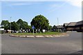
19 photos from this area
Area Information
Key information about the OX5 1RF including its size, population, and administrative classification.
- Area Type
- Postcode
- Area Size
- 18.3 hectares
- Population
- 1372
- Population Density
- 345 people/km²
House Prices in OX5 1RF
26
Properties
£179,458
Average Sold Price
£59,000
Lowest Price
£360,000
Highest Price
Showing 26 properties
| Address | Type | Beds | Baths | Last Sale Price | Last Sale Date | |
|---|---|---|---|---|---|---|
| 37 Evenlode Crescent, Kidlington, OX5 1RF | Semi-detached | 3 | 1 | £360,000 | Nov 2019 | |
| 34 Evenlode Crescent, Kidlington, OX5 1RF | Semi-detached | 3 | 1 | £300,000 | Apr 2018 | |
| 33 Evenlode Crescent, Kidlington, OX5 1RF | Semi-detached | 3 | - | £300,000 | Oct 2015 | |
| 40 Evenlode Crescent, Kidlington, OX5 1RF | house | - | - | £192,500 | Oct 2009 | |
| 23 Evenlode Crescent, Kidlington, OX5 1RF | Detached | - | - | £285,000 | Aug 2004 | |
| 43 Evenlode Crescent, Kidlington, OX5 1RF | Semi-detached | - | - | £175,000 | Jan 2003 | |
| 42 Evenlode Crescent, Kidlington, OX5 1RF | Semi-detached | - | - | £134,000 | Mar 2002 | |
| 41 Evenlode Crescent, Kidlington, OX5 1RF | Semi-detached | - | - | £118,000 | Jan 2001 | |
| 31 Evenlode Crescent, Kidlington, OX5 1RF | Semi-detached | - | - | £95,000 | Aug 1999 | |
| 39 Evenlode Crescent, Kidlington, OX5 1RF | Semi-detached | - | - | £73,000 | Apr 1998 |
Page 1 of 3
Energy Efficiency in OX5 1RF
Amenities
Schools
| Rank | School | Type | Entry gender | Ages |
|---|
Explore more schools in this area
Go to Schools tabDemographics
Household Size
Two person
most common
Accommodation Type
Houses
most common
Tenure
58
majority
Ethnic Group
White
most common
Religion
N/A
most common
Household Composition
N/A
most common
Age
47
median
Adults (30-64 years)
most common
Household Deprivation
N/A
with no deprivation
NS-SEC
35
in Lower managerial occupations
Explore more demographic insights in this area
Go to Demographics tabPlanning
Planning Constraints
- Flood RiskPremium
- Ramsar Wetland SitesPremium
- Area of Outstanding Natural BeautyPremium
- Protected Nature ReservePremium
- Protected WoodlandPremium