Area Overview for OX44 7NF
Photos of OX44 7NF


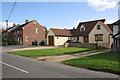

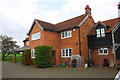


13 photos from this area
Area Information
Key information about the OX44 7NF including its size, population, and administrative classification.
- Area Type
- Postcode
- Area Size
- 4.1 hectares
- Population
- 1195
- Population Density
- 96 people/km²
House Prices in OX44 7NF
26
Properties
£735,700
Average Sold Price
£150,000
Lowest Price
£2,500,000
Highest Price
Showing 26 properties
| Address | Type | Beds | Baths | Last Sale Price | Last Sale Date | |
|---|---|---|---|---|---|---|
| Old Cottage, Lower End, Great Milton, Oxford, OX44 7NF | Terraced | 3 | 2 | £810,000 | Feb 2023 | |
| Yew Tree Cottage, Lower End, Great Milton, Oxford, OX44 7NF | house | 4 | - | £2,500,000 | Sep 2021 | |
| Tanners Cottage, Lower End, Great Milton, Oxford, OX44 7NF | Cottage | 4 | 3 | £1,200,000 | Jun 2021 | |
| Pegswell House, Lower End, Great Milton, Oxford, OX44 7NF | house | - | - | £1,588,000 | Feb 2021 | |
| Cotswold House, Lower End, Great Milton, Oxford, OX44 7NF | Detached | 4 | - | £875,000 | Oct 2017 | |
| Wades Cottage, Lower End, Great Milton, Oxford, OX44 7NF | Cottage | 2 | 1 | £360,000 | Mar 2016 | |
| Draycot, Lower End, Great Milton, Oxford, OX44 7NF | Cottage | 2 | 2 | £350,000 | Jan 2016 | |
| Pennard House, Lower End, Great Milton, Oxford, OX44 7NF | Detached | 4 | 2 | £525,000 | Nov 2014 | |
| Pitts Cottage, Lower End, Great Milton, Oxford, OX44 7NF | Semi-detached | 4 | 2 | £650,000 | Mar 2014 | |
| New Cottage, Lower End, Great Milton, Oxford, OX44 7NF | house | - | - | £307,500 | Nov 2013 |
Page 1 of 3
Energy Efficiency in OX44 7NF
Amenities
Schools
| Rank | School | Type | Entry gender | Ages |
|---|
Explore more schools in this area
Go to Schools tabDemographics
Household Size
Two person
most common
Accommodation Type
Houses
most common
Tenure
67
majority
Ethnic Group
White
most common
Religion
N/A
most common
Household Composition
N/A
most common
Age
47
median
Adults (30-64 years)
most common
Household Deprivation
N/A
with no deprivation
NS-SEC
42
in Lower managerial occupations
Explore more demographic insights in this area
Go to Demographics tabPlanning
Planning Constraints
- Flood RiskPremium
- Ramsar Wetland SitesPremium
- Area of Outstanding Natural BeautyPremium
- Protected Nature ReservePremium
- Protected WoodlandPremium