Area Overview for OX4 4PZ
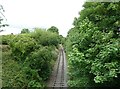
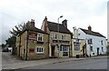
Photos of OX4 4PZ


Area Information
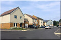
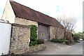
OX4 4PZ is a specific postcode area covering a small residential cluster in England. The location houses 2,195 residents within a tightly knit group of properties. This compact footprint creates immediate proximity between neighbours, though it lacks the sprawl of larger suburban developments. Daily life here revolves around practical access to local services and reliable transport links rather than expansive green spaces or major urban centres. The area functions as a quiet residential pocket where convenience is defined by walking distance to nearby shops and rail stations. You will find the environment is strictly utilitarian, focusing on stable housing and straightforward connectivity. There are no grand parks or major high streets attached directly to this postcode, so your daily routine depends on reaching the small but sufficient amenities located just outside the immediate boundaries. The layout supports a predictable lifestyle where you can manage your children's school runs and commute to work without navigating major traffic hubs. Living here means accepting a modest scale in exchange for a low-key existence away from the congestion of larger towns. The cluster offers a sense of contained community where the built environment serves a clear, singular purpose: providing homes for a defined population.
- Area Type
- Postcode
- Area Size
- Not available
- Population
- 2195
- Population Density
- 4219 people/km²
The property market in OX4 4PZ is characterised by a stock dominated by houses. Since accommodation type data specifies houses as the primary housing form, buyers should expect a landscape of detached or semi-detached properties rather than apartment blocks. This structure is typical for established residential clusters outside major urban cores. With home ownership at 36%, the area presents a dual-market dynamic where both freeholders and private tenants reside side by side. You will find that the majority of properties are likely rented, given that nearly two-thirds of the population does not own their homes. However, the presence of a third of owners indicates a significant market for existing stock sale. The small size of the postcode cluster means the total number of listings is limited, which could reduce competition but also restrict choice. Your search here will yield specific clusters of housing rather than diverse options spread across a wider neighbourhood. The absence of flat data reinforces that you cannot find flats within this specific geographic boundary. Buyers looking for traditional family homes in this style should focus their inquiries on this cluster, understanding that the variety of property sizes will be constrained by the overall population footprint.
House Prices in OX4 4PZ
No properties found in this postcode.
Energy Efficiency in OX4 4PZ
Your daily life in OX4 4PZ is shaped by proximity to a small but functional set of local amenities. Within practical reach, you have access to five retail outlets, including Sainsburys Heyford, Co-op Rose, and Co-op Cowley. These supermarkets offer essential grocery shopping without the need to travel to larger centres. Transport links are supported by four railway stations in the vicinity: Radley Railway Station, Culham Railway Station, and Appleford Railway Station. These stations provide regular connections that take you beyond the local cluster to wider opportunities. The limited number of amenities reflects the residential focus of the area, but the selection around the OX4 4PZ postcode boundary is adequate for weekly needs. You will find that dining options and leisure facilities are less prominent in the immediate data, directing you toward the named retailers and rail nodes for your primary errands. The lifestyle here is practical and efficient, relying on established chains and reliable rail infrastructure to fill any gaps in local provision.
Amenities
Schools
Families living in OX4 4PZ have access to a mix of state and independent education options within practical reach. The nearest primary schools include Speedwell First School, Peers School, Lawn Upton Church of England Middle School, and The John Henry Newman CofE (A) Primary School. All of these institutions are designated as primary schools, catering to younger children. For families seeking independent education, Emmanuel Christian School offers an alternative option and holds a good Ofsted rating. This range of choices means you can select between local state provisions or a faith-based independent institution. The availability of primary schools close to the postcode suggests that young children do not need to travel far to start their education. However, the data lists only primary and middle-level institutions, so there is no explicit information regarding secondary schools attached directly to this cluster. You will need to identify how these primary institutions feed into broader catchment areas for older children. The presence of a rated independent school adds variety to the educational landscape available to residents of this small residential area.
| Rank | School | Type | Entry gender | Ages |
|---|
Explore more schools in this area
Go to Schools tabDemographics
The community in OX4 4PZ is defined by a mature demographic profile. The median age is 47 years, with adults between 30 and 64 years old forming the most common age range. This suggests the area is not a destination for young families or recent graduates, but rather a settled location for established households. You will find that the population is predominantly White, reflecting the broader demographic trends of the region. Home ownership currently stands at 36%, which indicates that the remaining 64% of residents are tenants. This split creates a mixed market where both owners and renters share the same streets. Houses are the predominant form of accommodation, meaning you will not find flats or high-rise buildings as standard housing stock. There is little indication of rapid demographic shifts within this small cluster. The age distribution supports a stable neighbourhood where families and professionals coexist with elderly residents. Deprivation levels are not explicitly quantified in the available figures, preventing a direct statistical analysis of social disadvantage. Instead, the data points toward a typical residential setting without the concentration of young professionals or students often found in city centre outskirts. The demographic stability offers predictability for anyone considering moving into this residential zone.
Household Size
Accommodation Type
Tenure
Ethnic Group
Religion
Household Composition
Age
Household Deprivation
NS-SEC
Explore more demographic insights in this area
Go to Demographics tabPlanning
Planning Constraints
- Flood RiskPremium
- Ramsar Wetland SitesPremium
- Area of Outstanding Natural BeautyPremium
- Protected Nature ReservePremium
- Protected WoodlandPremium