Area Overview for OX4 4AU
Photos of OX4 4AU
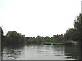
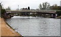

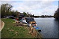
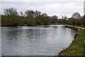

100 photos from this area
Area Information
Key information about the OX4 4AU including its size, population, and administrative classification.
- Area Type
- Postcode
- Area Size
- 6515 m²
- Population
- 1872
- Population Density
- 4060 people/km²
House Prices in OX4 4AU
23
Properties
£373,833
Average Sold Price
£60,000
Lowest Price
£858,000
Highest Price
Showing 23 properties
| Address | Type | Beds | Baths | Last Sale Price | Last Sale Date | |
|---|---|---|---|---|---|---|
| 344 Iffley Road, Oxford, OX4 4AU | Semi-detached | 6 | 3 | £858,000 | Jun 2022 | |
| 324 Iffley Road, Oxford, OX4 4AU | Flat | - | - | £203,500 | Jul 2007 | |
| 332 Iffley Road, Oxford, OX4 4AU | Flat | - | - | £60,000 | Feb 1998 | |
| Wroxton House, 346 Iffley Road, Oxford, OX4 4AU | Semi-detached | 4 | 2 | - | - | |
| 342 Iffley Road, Oxford, OX4 4AU | Flat | 5 | - | - | - | |
| Even 322 To 332, Iffley Road, Oxford, OX4 4AU | Detached | - | - | - | - | |
| Annexe Flat, 350 Iffley Road, Oxford, OX4 4AU | Flat | - | - | - | - | |
| 340 Iffley Road, Oxford, OX4 4AU | Flat | - | - | - | - | |
| 320 Iffley Road, Oxford, OX4 4AU | Flat | - | - | - | - | |
| 316 Iffley Road, Oxford, OX4 4AU | Flat | - | - | - | - |
Page 1 of 3
Energy Efficiency in OX4 4AU
Amenities
Schools
| Rank | School | Type | Entry gender | Ages |
|---|
Explore more schools in this area
Go to Schools tabDemographics
Household Size
Family (3-5 people)
most common
Accommodation Type
Houses
most common
Tenure
40
majority
Ethnic Group
White
most common
Religion
N/A
most common
Household Composition
N/A
most common
Age
47
median
Adults (30-64 years)
most common
Household Deprivation
N/A
with no deprivation
NS-SEC
34
in Lower managerial occupations
Explore more demographic insights in this area
Go to Demographics tabPlanning
Planning Constraints
- Flood RiskPremium
- Ramsar Wetland SitesPremium
- Area of Outstanding Natural BeautyPremium
- Protected Nature ReservePremium
- Protected WoodlandPremium