Area Overview for OX4 3SE
Photos of OX4 3SE
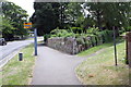
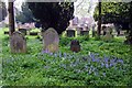
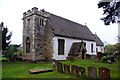
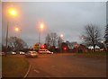
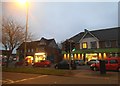
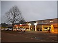
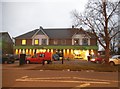
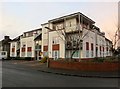
52 photos from this area
Area Information
Key information about the OX4 3SE including its size, population, and administrative classification.
- Area Type
- Postcode
- Area Size
- 3.1 hectares
- Population
- 1535
- Population Density
- 5317 people/km²
House Prices in OX4 3SE
21
Properties
£305,623
Average Sold Price
£106,500
Lowest Price
£527,300
Highest Price
Showing 21 properties
| Address | Type | Beds | Baths | Last Sale Price | Last Sale Date | |
|---|---|---|---|---|---|---|
| 24 Church Hill Road, Oxford, OX4 3SE | Semi-detached | 3 | 1 | £450,000 | Nov 2023 | |
| 16 Church Hill Road, Oxford, OX4 3SE | Semi-detached | 3 | 1 | £435,000 | Oct 2020 | |
| 4 Church Hill Road, Oxford, OX4 3SE | Semi-detached | 3 | 2 | £522,810 | Dec 2018 | |
| 34 Church Hill Road, Oxford, OX4 3SE | Semi-detached | 4 | 1 | £527,300 | Dec 2017 | |
| 18 Church Hill Road, Oxford, OX4 3SE | Semi-detached | 3 | - | £330,000 | Feb 2014 | |
| 12 Church Hill Road, Oxford, OX4 3SE | house | 3 | - | £312,000 | Jul 2010 | |
| 32 Church Hill Road, Oxford, OX4 3SE | Terraced | - | - | £375,000 | Aug 2007 | |
| 22 Church Hill Road, Oxford, OX4 3SE | Semi-detached | - | - | £267,000 | Oct 2006 | |
| 38A Church Hill Road, Oxford, OX4 3SE | Detached | 3 | 2 | £249,995 | May 2004 | |
| 6 Church Hill Road, Oxford, OX4 3SE | Semi-detached | - | - | £142,500 | Oct 1999 |
Page 1 of 3
Energy Efficiency in OX4 3SE
Amenities
Schools
| Rank | School | Type | Entry gender | Ages |
|---|
Explore more schools in this area
Go to Schools tabDemographics
Household Size
Family (3-5 people)
most common
Accommodation Type
Houses
most common
Tenure
65
majority
Ethnic Group
White
most common
Religion
N/A
most common
Household Composition
N/A
most common
Age
47
median
Adults (30-64 years)
most common
Household Deprivation
N/A
with no deprivation
NS-SEC
44
in Lower managerial occupations
Explore more demographic insights in this area
Go to Demographics tabPlanning
Planning Constraints
- Flood RiskPremium
- Ramsar Wetland SitesPremium
- Area of Outstanding Natural BeautyPremium
- Protected Nature ReservePremium
- Protected WoodlandPremium