Area Overview for OX4 3LB
Photos of OX4 3LB
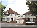
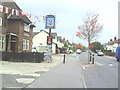
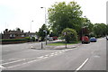
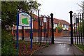
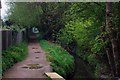
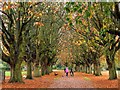
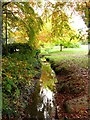
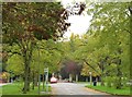
81 photos from this area
Area Information
Key information about the OX4 3LB including its size, population, and administrative classification.
- Area Type
- Postcode
- Area Size
- 1.1 hectares
- Population
- 1680
- Population Density
- 6685 people/km²
House Prices in OX4 3LB
31
Properties
£246,893
Average Sold Price
£86,500
Lowest Price
£520,000
Highest Price
Showing 31 properties
| Address | Type | Beds | Baths | Last Sale Price | Last Sale Date | |
|---|---|---|---|---|---|---|
| 52 Rymers Lane, Oxford, OX4 3LB | Semi-detached | 4 | 2 | £375,000 | Jun 2021 | |
| 52A Rymers Lane, Oxford, OX4 3LB | house | - | - | £520,000 | Mar 2021 | |
| 36 Rymers Lane, Oxford, OX4 3LB | Terraced | 3 | 1 | £200,000 | Sep 2017 | |
| 48 Rymers Lane, Oxford, OX4 3LB | Terraced | 3 | 1 | £340,000 | Jun 2017 | |
| 44 Rymers Lane, Oxford, OX4 3LB | Terraced | 3 | - | £281,000 | Jul 2013 | |
| 60 Rymers Lane, Oxford, OX4 3LB | house | - | - | £202,000 | Apr 2011 | |
| 50 Rymers Lane, Oxford, OX4 3LB | house | - | - | £240,000 | Feb 2008 | |
| 42 Rymers Lane, Oxford, OX4 3LB | house | 4 | - | £243,000 | Nov 2006 | |
| 46 Rymers Lane, Oxford, OX4 3LB | Terraced | - | - | £217,000 | Apr 2006 | |
| 54 Rymers Lane, Oxford, OX4 3LB | house | 4 | - | £185,000 | Oct 2004 |
Page 1 of 4
Energy Efficiency in OX4 3LB
Amenities
Schools
| Rank | School | Type | Entry gender | Ages |
|---|
Explore more schools in this area
Go to Schools tabDemographics
Household Size
Family (3-5 people)
most common
Accommodation Type
Houses
most common
Tenure
51
majority
Ethnic Group
White
most common
Religion
N/A
most common
Household Composition
N/A
most common
Age
47
median
Adults (30-64 years)
most common
Household Deprivation
N/A
with no deprivation
NS-SEC
29
in Lower managerial occupations
Explore more demographic insights in this area
Go to Demographics tabPlanning
Planning Constraints
- Flood RiskPremium
- Ramsar Wetland SitesPremium
- Area of Outstanding Natural BeautyPremium
- Protected Nature ReservePremium
- Protected WoodlandPremium