Area Overview for OX4 3AU
Photos of OX4 3AU

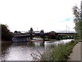
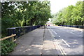
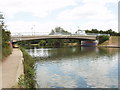
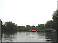

100 photos from this area
Area Information
Key information about the OX4 3AU including its size, population, and administrative classification.
- Area Type
- Postcode
- Area Size
- 9365 m²
- Population
- 2272
- Population Density
- 12757 people/km²
House Prices in OX4 3AU
34
Properties
£394,060
Average Sold Price
£85,000
Lowest Price
£635,000
Highest Price
Showing 34 properties
| Address | Type | Beds | Baths | Last Sale Price | Last Sale Date | |
|---|---|---|---|---|---|---|
| 29 Charles Street, Oxford, OX4 3AU | Terraced | 2 | 1 | £517,500 | Jun 2024 | |
| 33 Charles Street, Oxford, OX4 3AU | house | - | - | £508,700 | Dec 2021 | |
| 65 Charles Street, Oxford, OX4 3AU | house | - | - | £515,000 | Sep 2021 | |
| 19 Charles Street, Oxford, OX4 3AU | house | - | - | £505,000 | May 2021 | |
| 17 Charles Street, Oxford, OX4 3AU | house | - | - | £490,000 | Feb 2021 | |
| 15 Charles Street, Oxford, OX4 3AU | Terraced | 4 | 1 | £490,000 | Feb 2021 | |
| 11 Charles Street, Oxford, OX4 3AU | Semi-detached | 3 | 2 | £590,000 | Feb 2020 | |
| 57 Charles Street, Oxford, OX4 3AU | Terraced | 3 | 1 | £635,000 | Aug 2017 | |
| 41 Charles Street, Oxford, OX4 3AU | house | - | - | £565,000 | Aug 2017 | |
| 39 Charles Street, Oxford, OX4 3AU | house | - | - | £525,000 | Aug 2016 |
Page 1 of 4
Energy Efficiency in OX4 3AU
Amenities
Schools
| Rank | School | Type | Entry gender | Ages |
|---|
Explore more schools in this area
Go to Schools tabDemographics
Household Size
Family (3-5 people)
most common
Accommodation Type
Houses
most common
Tenure
45
majority
Ethnic Group
White
most common
Religion
N/A
most common
Household Composition
N/A
most common
Age
47
median
Adults (30-64 years)
most common
Household Deprivation
N/A
with no deprivation
NS-SEC
41
in Lower managerial occupations
Explore more demographic insights in this area
Go to Demographics tabPlanning
Planning Constraints
- Flood RiskPremium
- Ramsar Wetland SitesPremium
- Area of Outstanding Natural BeautyPremium
- Protected Nature ReservePremium
- Protected WoodlandPremium