Area Overview for OX4 2NY
Photos of OX4 2NY
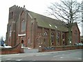

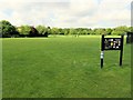

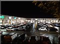
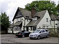


87 photos from this area
Area Information
Key information about the OX4 2NY including its size, population, and administrative classification.
- Area Type
- Postcode
- Area Size
- 1.2 hectares
- Population
- 2069
- Population Density
- 2725 people/km²
House Prices in OX4 2NY
45
Properties
£352,535
Average Sold Price
£75,500
Lowest Price
£717,500
Highest Price
Showing 45 properties
| Address | Type | Beds | Baths | Last Sale Price | Last Sale Date | |
|---|---|---|---|---|---|---|
| 87 Crescent Road, Oxford, OX4 2NY | Semi-detached | 4 | 2 | £525,000 | Dec 2024 | |
| 123 Crescent Road, Oxford, OX4 2NY | Terraced | 4 | 2 | £590,000 | Dec 2024 | |
| 95 Crescent Road, Oxford, OX4 2NY | Detached | 3 | 2 | £685,500 | Dec 2022 | |
| 75 Crescent Road, Oxford, OX4 2NY | Detached | 3 | 1 | £505,000 | Sep 2022 | |
| 81 Crescent Road, Oxford, OX4 2NY | house | - | - | £717,500 | Aug 2020 | |
| 73A Crescent Road, Oxford, OX4 2NY | Detached | 3 | 1 | £447,600 | Jul 2020 | |
| 63 Crescent Road, Oxford, OX4 2NY | Detached | 3 | 1 | £395,000 | Apr 2020 | |
| 147 Crescent Road, Oxford, OX4 2NY | Terraced | 4 | 2 | £385,000 | Apr 2019 | |
| 111 Crescent Road, Oxford, OX4 2NY | Semi-detached | 4 | - | £475,000 | Oct 2016 | |
| 125 Crescent Road, Oxford, OX4 2NY | Terraced | 3 | - | £349,000 | Feb 2016 |
Page 1 of 5
Energy Efficiency in OX4 2NY
Amenities
Schools
| Rank | School | Type | Entry gender | Ages |
|---|
Explore more schools in this area
Go to Schools tabDemographics
Household Size
Two person
most common
Accommodation Type
Houses
most common
Tenure
49
majority
Ethnic Group
White
most common
Religion
N/A
most common
Household Composition
N/A
most common
Age
47
median
Adults (30-64 years)
most common
Household Deprivation
N/A
with no deprivation
NS-SEC
44
in Lower managerial occupations
Explore more demographic insights in this area
Go to Demographics tabPlanning
Planning Constraints
- Flood RiskPremium
- Ramsar Wetland SitesPremium
- Area of Outstanding Natural BeautyPremium
- Protected Nature ReservePremium
- Protected WoodlandPremium