Area Overview for OX4 2FG
Photos of OX4 2FG


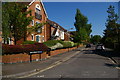
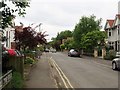
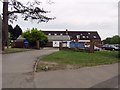
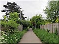
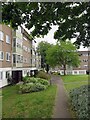
100 photos from this area
Area Information
Key information about the OX4 2FG including its size, population, and administrative classification.
- Area Type
- Postcode
- Area Size
- 5541 m²
- Population
- 2957
- Population Density
- 4493 people/km²
House Prices in OX4 2FG
23
Properties
£422,852
Average Sold Price
£259,995
Lowest Price
£630,000
Highest Price
Showing 23 properties
| Address | Type | Beds | Baths | Last Sale Price | Last Sale Date | |
|---|---|---|---|---|---|---|
| 33 Reliance Way, Oxford, OX4 2FG | Terraced | 3 | 2 | £458,000 | Mar 2025 | |
| 52 Reliance Way, Oxford, OX4 2FG | Semi-detached | 4 | 3 | £550,800 | Jan 2025 | |
| 78 Reliance Way, Oxford, OX4 2FG | house | - | - | £582,500 | Jul 2024 | |
| 27 Reliance Way, Oxford, OX4 2FG | house | 3 | 2 | £450,000 | Apr 2022 | |
| 80 Reliance Way, Oxford, OX4 2FG | house | 4 | 3 | £550,000 | Apr 2021 | |
| 48 Reliance Way, Oxford, OX4 2FG | Semi-detached | 4 | 2 | £545,000 | Nov 2020 | |
| 54 Reliance Way, Oxford, OX4 2FG | Semi-detached | 4 | 2 | £525,000 | Oct 2020 | |
| 35 Reliance Way, Oxford, OX4 2FG | house | 4 | - | £575,000 | Sep 2020 | |
| 62 Reliance Way, Oxford, OX4 2FG | house | - | - | £630,000 | Feb 2019 | |
| 19 Reliance Way, Oxford, OX4 2FG | house | - | - | £420,000 | Aug 2017 |
Page 1 of 3
Energy Efficiency in OX4 2FG
Amenities
Schools
| Rank | School | Type | Entry gender | Ages |
|---|
Explore more schools in this area
Go to Schools tabDemographics
Household Size
Family (3-5 people)
most common
Accommodation Type
Houses
most common
Tenure
32
majority
Ethnic Group
White
most common
Religion
N/A
most common
Household Composition
N/A
most common
Age
22
median
Adults (30-64 years)
most common
Household Deprivation
N/A
with no deprivation
NS-SEC
31
in Lower managerial occupations
Explore more demographic insights in this area
Go to Demographics tabPlanning
Planning Constraints
- Flood RiskPremium
- Ramsar Wetland SitesPremium
- Area of Outstanding Natural BeautyPremium
- Protected Nature ReservePremium
- Protected WoodlandPremium