Area Overview for OX4 2BW
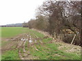
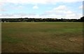
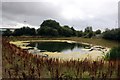
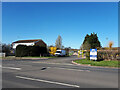
Photos of OX4 2BW


Area Information
Living in OX4 2BW offers a defined residential experience within a specific postcode covering 99.8 hectares. This cluster serves a small population of 2,095 people, creating a setting where local life plays out in a concentrated environment. The area stands out for its clear boundaries and manageable scale, making it easy for you to navigate daily routines without the overwhelm found in larger towns. Residents here enjoy a postcode area described as a small residential cluster, which fosters a sense of locality. You will find yourself in a zone defined by its precise dimensions of 99.8 hectares, distinguishing it from neighbouring districts. The demographic profile, with a median age of 47, gives the neighbourhood a settled character. This statistical snapshot reflects a community where stability is common. Families and professionals choose homes in OX4 2BW knowing they are entering a compact, well-defined part of Oxfordshire. The housing stock consists primarily of houses, shaping the physical landscape into a traditional residential neighbourhood. Understanding the size of this area helps you gauge the distance to amenities and the pace of local life. It is a place where the boundaries are clear, and the community functions as a distinct unit within the wider region.
- Area Type
- Postcode
- Area Size
- 99.8 hectares
- Population
- 2095
- Population Density
- 1149 people/km²
The housing market in OX4 2BW is characterised by a stable mix where half of residents own their properties. This 50 per cent home ownership rate indicates a balanced area where buying is common but not exclusive. Houses dominate the landscape as the primary accommodation type, meaning you will not find high-rise flats or converted student buildings here. The physical stock consists of standalone or semi-detached homes suited to families and established professionals. This distribution of housing types means buyers looking at homes in OX4 2BW should primarily engage with agents specialising in detached or terraced family properties. The small residential cluster nature of this 99.8 hectare postcode means property values are influenced by local scarcity rather than regional speculation. With a population of 2,095, the market moves with a certain rhythm defined by local needs rather than massive influxes of commuters. You will find that the housing stock is geared towards permanent residents who intend to stay for multiple years. The lack of social housing dominance supports a market where buyers can access properties through traditional purchase routes. When considering buying in this area, note that the housing stock reflects the older median age of 47 years. This suggests many homes may have been built for previous generations but remain updated for modern living. The 50 per cent ownership rate ensures a steady base of sellers available for buyers seeking to enter the market.
House Prices in OX4 2BW
Showing 1 properties
| Address | Type | Beds | Baths | Last Sale Price | Last Sale Date | |
|---|---|---|---|---|---|---|
| Cygnet Foods Ltd (uys Ltd), U Y S Ltd, Garsington Road, Oxford, OX4 2BW | general_industrial | - | - | - | - |
Energy Efficiency in OX4 2BW
Daily life in OX4 2BW benefits from a practical array of amenities within easy reach. You can shop at Lidl Cowley, M&S Cowley Rd Oxford SF, and Iceland Oxford, ensuring essential grocery needs are met without long journeys. These five retail outlets Span the necessities from fresh produce to household goods in a single trip. For those prioritising commuting by rail, two stations serve the area including Radley Railway Station and Culham Railway Station. This gives residents multiple options for travelling around Oxfordshire and connecting to the wider network. Chalgrove Airport another nearby amenity provides opportunities for private aviation or specialised transport logistics. These five specific retail venues and three transport nodes define the lifestyle convenience for anyone living here. The presence of M&S Cowley Rd Oxford SF means quality shopping is accessible without leaving the immediate vicinity. You can stock your kitchen at Iceland Oxford and manage household items at Cowley stores quickly. The combination of diverse transport links and varied retail choices creates a self-contained lifestyle hub. Even though this is a small residential cluster of 99.8 hectares, the nearest amenities ensure you do not feel isolated. When planning your weekly routine, you will find these specific names appear frequently on your shopping and commute lists.
Amenities
Schools
Families living near OX4 2BW have access to established educational institutions within practical reach. St John Bosco RC Middle School stands as the key nearby school listed for this postcode. As a primary school, it serves the younger demographics of the community and contributes to the area's reputation for family suitability. The presence of this single primary option means that children in early education stages have a designated local facility. This specific school name offers a clear reference point for parents evaluating schools near OX4 2BW without ambiguity. The school type indicates a religious education focus, which may appeal to families with specific faith preferences. While the data does not list secondary options, the presence of a primary school confirms that early education is a priority for residents. When you consider children living in this postcode, the proximity to St John Bosco RC Middle School forms part of your decision matrix. The school type classification provides immediate insight into the curriculum and ethos without needing further research. This factual listing ensures that you know exactly what educational infrastructure supports the 2,095 residents. The school remains a central point for community interaction and parent involvement. For those analysing schools near OX4 2BW, this named institution provides the concrete information required for planning.
| Rank | School | Type | Entry gender | Ages |
|---|
Explore more schools in this area
Go to Schools tabDemographics
The community in OX4 2BW reflects a settled demographic with a median age of 47 years. Most residents fall into the adult range between 30 and 64 years, indicating a population built around active working lives and family raising years. Half of the households own their homes outright, a figure representing exactly 50 per cent of the total. This balance suggests a significant portion of the population has financial stability and roots in the area. The remaining accommodation is split between other tenure types, though owner residence remains a dominant feature. Houses form the primary accommodation type visible across the postcode, confirming the area's role as a family and adult-oriented neighbourhood. The predominant ethnic group is White, which aligns with the broader demographic trends often seen in this specific section of Oxfordshire. With over 2,000 people living in 99.8 hectares, the population density reaches 1,149 people per square kilometre. This density ensures that services are within practical reach while maintaining a relatively established feel. The age profile explains why local schools and amenities cater to children and adults rather than youngest demographics. You can expect a neighbourhood where neighbours are likely to be in similar life stages. This consistency creates an environment where housing choices tend to reflect long-term living needs rather than short-term rentals.
Household Size
Accommodation Type
Tenure
Ethnic Group
Religion
Household Composition
Age
Household Deprivation
NS-SEC
Explore more demographic insights in this area
Go to Demographics tabPlanning
Planning Constraints
- Flood RiskPremium
- Ramsar Wetland SitesPremium
- Area of Outstanding Natural BeautyPremium
- Protected Nature ReservePremium
- Protected WoodlandPremium