Area Overview for OX4 1YN
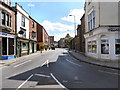
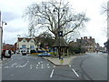
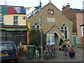
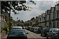
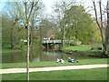
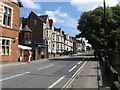
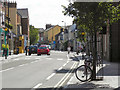
Photos of OX4 1YN


Area Information
Living in OX4 1YN means settling into a specific postcode area covering a small residential cluster rather than a sprawling neighbourhood. You will find around 1,222 people calling this place home, creating a closely knit environment where neighbours likely know each other's names. The area sits within England, offering a slice of suburban life that is defined by its compact size and distinct identity. Daily life here revolves around the immediate community, as the small population means shops and services are accessed quickly or via the nearby rail network. Residents of OX4 1YN experience a lifestyle where the physical distance to neighbours is short, yet the connection to wider Oxfordshire is maintained through excellent transport links. The character of this location is shaped by its function as a small residential hub, balancing local convenience with proximity to larger urban centres. For anyone considering homes in OX4 1YN, the reality is a straightforward living situation without the anonymity of a major city district. You would trade the bustle of Oxford city centre for the quiet stability of a designated cluster where community presence is front and centre. This postcode represents a practical choice for those who value a defined, manageable living space over expansive sprawl.
- Area Type
- Postcode
- Area Size
- Not available
- Population
- 1222
- Population Density
- 6692 people/km²
The property market in OX4 1YN is characterised by a predominantly rental landscape with a minority of owner-occupied homes. With a home ownership rate of just 22%, you will find that most people in this postcode do not own their homes outright. This statistic is significant for buyers looking to enter the market here, as it suggests a high volume of rental turnover and potential competition for available properties. The accommodation type is mostly houses, which offers a different living experience to the high-rise apartments common in other parts of Oxfordshire. You are dealing with a smaller area where houses make up the bulk of the housing stock, yet the low ownership percentage implies these homes change hands frequently between owners and renters. For anyone eyeing homes in OX4 1YN, the market feels fluid and responsive to the needs of young adults rather than established families seeking to build equity. The prevalence of rental properties suggests that the local economy attracts people who are transient or on temporary contracts. Whether you are looking to buy or rent, the market here is driven by affordability and accessibility, ensuring that homes remain available for those moving between job opportunities or accommodation styles.
House Prices in OX4 1YN
No properties found in this postcode.
Energy Efficiency in OX4 1YN
Your lifestyle in OX4 1YN is supported by a cluster of essential amenities within practical reach of residents. You have access to local retail options including Sainsburys Oxford and Tesco Oxford, ensuring your weekly shopping requirements are met without extensive travel. The area serves as a residential link to major rail networks, with Oxford Parkway Railway Station, Radley Railway Station, and Islip Railway Station available nearby. These transport hubs provide direct routes to Oxford city centre and beyond, allowing you to commute efficiently if you work outside the immediate vicinity. The presence of supermarkets and railway stations means daily errands are manageable, even in this small residential cluster. You do not need to rely solely on private vehicle travel, as the combination of walking distance shops and frequent rail services creates a flexible daily routine. Dining and leisure options are conveniently located in the surrounding Oxford area, accessible via short trips. This mix of local convenience and nearby transport infrastructure defines the character of living here, offering a balance between quiet home life and urban accessibility.
Amenities
Schools
| Rank | School | Type | Entry gender | Ages |
|---|
Explore more schools in this area
Go to Schools tabDemographics
The community in OX4 1YN is defined by a very young demographic profile. The median age sits at just 22 years, indicating that the majority of residents are young adults aged between 15 and 29 years. You are looking at an area where families with young children are less common than individuals or couples starting their careers. Home ownership stands at 22%, meaning that roughly only one in five households owns their property outright. The rest of the occupants are likely tenants, reflecting a rental market that dominates the local housing scene. Most people live in houses, which contrasts with the high-density flats often found in city centres. The predominant ethnic group is White, though the young age profile suggests a dynamic population constantly changing as graduates move through the area. This demographic mix creates a social environment heavily focused on affordability and shared living arrangements rather than established estates. If you care about the age of your neighbours, the data shows a population that has not yet settled into long-term family-life stages. The low ownership rate means turnover is frequent, and the community lacks the multi-generational depth found in older suburbs.
Household Size
Accommodation Type
Tenure
Ethnic Group
Religion
Household Composition
Age
Household Deprivation
NS-SEC
Explore more demographic insights in this area
Go to Demographics tabPlanning
Planning Constraints
- Flood RiskPremium
- Ramsar Wetland SitesPremium
- Area of Outstanding Natural BeautyPremium
- Protected Nature ReservePremium
- Protected WoodlandPremium