Area Overview for OX4 1UT
Photos of OX4 1UT

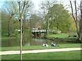
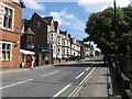
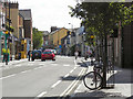
100 photos from this area
Area Information
Key information about the OX4 1UT including its size, population, and administrative classification.
- Area Type
- Postcode
- Area Size
- 7494 m²
- Population
- 1351
- Population Density
- 4058 people/km²
House Prices in OX4 1UT
100
Properties
£78,750
Average Sold Price
£50,000
Lowest Price
£107,500
Highest Price
Showing 100 properties
| Address | Type | Beds | Baths | Last Sale Price | Last Sale Date | |
|---|---|---|---|---|---|---|
| 187A Cowley Road, Oxford, OX4 1UT | restaurant_cafe | - | - | £50,000 | Mar 2022 | |
| 183A Cowley Road, Oxford, OX4 1UT | Flat | - | - | £107,500 | May 1997 | |
| 177A Cowley Road, Oxford, OX4 1UT | Maisonette | 6 | 2 | - | - | |
| Flat Above, 189 Cowley Road, Oxford, OX4 1UT | Flat | - | - | - | - | |
| The Cowley Retreat, Cowley Road, Oxford, OX4 1UT | Flat | 4 | 1 | - | - | |
| Flat, 183 Cowley Road, Oxford, OX4 1UT | Flat | - | - | - | - | |
| 175A Cowley Road, Oxford, OX4 1UT | Flat | 4 | 1 | - | - | |
| 185A Cowley Road, Oxford, OX4 1UT | Terraced | 3 | 1 | - | - | |
| 177B Cowley Road, Oxford, OX4 1UT | Flat | 3 | - | - | - | |
| Tara Yoga Centre, First Floor Office, Crown House, 193 Cowley Road, Oxford, OX4 1UT | residential_space | - | - | - | - |
Page 1 of 10
Energy Efficiency in OX4 1UT
Amenities
Schools
| Rank | School | Type | Entry gender | Ages |
|---|
Explore more schools in this area
Go to Schools tabDemographics
Household Size
Family (3-5 people)
most common
Accommodation Type
Houses
most common
Tenure
31
majority
Ethnic Group
White
most common
Religion
N/A
most common
Household Composition
N/A
most common
Age
22
median
Young Adults (15-29 years)
most common
Household Deprivation
N/A
with no deprivation
NS-SEC
34
in Lower managerial occupations
Explore more demographic insights in this area
Go to Demographics tabPlanning
Planning Constraints
- Flood RiskPremium
- Ramsar Wetland SitesPremium
- Area of Outstanding Natural BeautyPremium
- Protected Nature ReservePremium
- Protected WoodlandPremium