Area Overview for OX4 1TH
Photos of OX4 1TH


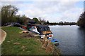
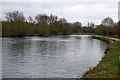
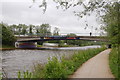
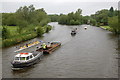

100 photos from this area
Area Information
Key information about the OX4 1TH including its size, population, and administrative classification.
- Area Type
- Postcode
- Area Size
- 6285 m²
- Population
- 1871
- Population Density
- 3834 people/km²
House Prices in OX4 1TH
48
Properties
£451,333
Average Sold Price
£90,000
Lowest Price
£865,000
Highest Price
Showing 48 properties
| Address | Type | Beds | Baths | Last Sale Price | Last Sale Date | |
|---|---|---|---|---|---|---|
| 1 Fairacres Road, Oxford, OX4 1TH | Flat | 1 | 1 | £810,000 | Oct 2021 | |
| 47 Fairacres Road, Oxford, OX4 1TH | house | - | - | £685,000 | Sep 2021 | |
| 51 Fairacres Road, Oxford, OX4 1TH | house | - | - | £865,000 | Jan 2020 | |
| 49 Fairacres Road, Oxford, OX4 1TH | house | - | - | £670,000 | Nov 2017 | |
| 1A Fairacres Road, Oxford, OX4 1TH | Detached | 4 | 2 | £725,000 | Jul 2016 | |
| 35 Fairacres Road, Oxford, OX4 1TH | house | - | - | £460,000 | Jul 2016 | |
| 3 Fairacres Road, Oxford, OX4 1TH | house | - | - | £457,500 | Mar 2014 | |
| 33 Fairacres Road, Oxford, OX4 1TH | house | 3 | - | £405,000 | Jul 2012 | |
| 19 Fairacres Road, Oxford, OX4 1TH | house | - | - | £500,000 | Nov 2007 | |
| 11 Fairacres Road, Oxford, OX4 1TH | Terraced | 2 | - | £340,000 | Aug 2006 |
Page 1 of 5
Energy Efficiency in OX4 1TH
Amenities
Schools
| Rank | School | Type | Entry gender | Ages |
|---|
Explore more schools in this area
Go to Schools tabDemographics
Household Size
Family (3-5 people)
most common
Accommodation Type
Houses
most common
Tenure
53
majority
Ethnic Group
White
most common
Religion
N/A
most common
Household Composition
N/A
most common
Age
22
median
Young Adults (15-29 years)
most common
Household Deprivation
N/A
with no deprivation
NS-SEC
53
in Lower managerial occupations
Explore more demographic insights in this area
Go to Demographics tabPlanning
Planning Constraints
- Flood RiskPremium
- Ramsar Wetland SitesPremium
- Area of Outstanding Natural BeautyPremium
- Protected Nature ReservePremium
- Protected WoodlandPremium