Area Overview for OX4 1RB
Photos of OX4 1RB
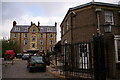
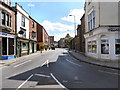
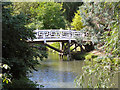
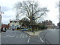
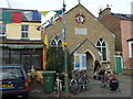
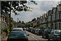
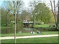
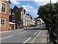
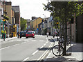
100 photos from this area
Area Information
Key information about the OX4 1RB including its size, population, and administrative classification.
- Area Type
- Postcode
- Area Size
- 8944 m²
- Population
- 1886
- Population Density
- 10741 people/km²
House Prices in OX4 1RB
61
Properties
£424,881
Average Sold Price
£123,000
Lowest Price
£647,500
Highest Price
Showing 61 properties
| Address | Type | Beds | Baths | Last Sale Price | Last Sale Date | |
|---|---|---|---|---|---|---|
| 29 Magdalen Road, Oxford, OX4 1RB | Terraced | 3 | 1 | £517,000 | Oct 2024 | |
| 34 Magdalen Road, Oxford, OX4 1RB | Terraced | 3 | 1 | £625,000 | Apr 2024 | |
| 48 Magdalen Road, Oxford, OX4 1RB | house | - | - | £469,000 | Jan 2024 | |
| 45A Magdalen Road, Oxford, OX4 1RB | Terraced | 3 | 2 | £647,500 | Nov 2023 | |
| 57 Magdalen Road, Oxford, OX4 1RB | house | 6 | 3 | £530,000 | Feb 2023 | |
| 55 Magdalen Road, Oxford, OX4 1RB | house | 3 | - | £500,000 | Jun 2021 | |
| 31 Magdalen Road, Oxford, OX4 1RB | Terraced | 3 | 1 | £400,000 | Nov 2020 | |
| 41 Magdalen Road, Oxford, OX4 1RB | Retail | - | - | £610,000 | Dec 2019 | |
| 47 Magdalen Road, Oxford, OX4 1RB | Terraced | 4 | 1 | £440,000 | Apr 2019 | |
| 51 Magdalen Road, Oxford, OX4 1RB | Terraced | 3 | 1 | £499,999 | Mar 2019 |
Page 1 of 7
Energy Efficiency in OX4 1RB
Amenities
Schools
| Rank | School | Type | Entry gender | Ages |
|---|
Explore more schools in this area
Go to Schools tabDemographics
Household Size
Family (3-5 people)
most common
Accommodation Type
Houses
most common
Tenure
28
majority
Ethnic Group
White
most common
Religion
N/A
most common
Household Composition
N/A
most common
Age
22
median
Young Adults (15-29 years)
most common
Household Deprivation
N/A
with no deprivation
NS-SEC
32
in Lower managerial occupations
Explore more demographic insights in this area
Go to Demographics tabPlanning
Planning Constraints
- Flood RiskPremium
- Ramsar Wetland SitesPremium
- Area of Outstanding Natural BeautyPremium
- Protected Nature ReservePremium
- Protected WoodlandPremium