Area Overview for OX4 1PD
Photos of OX4 1PD
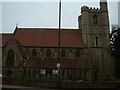
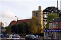
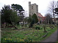
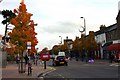

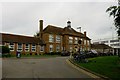
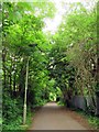
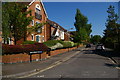
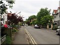
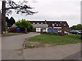
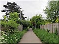
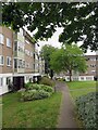
100 photos from this area
Area Information
Key information about the OX4 1PD including its size, population, and administrative classification.
- Area Type
- Postcode
- Area Size
- 14.7 hectares
- Population
- 1605
- Population Density
- 2731 people/km²
House Prices in OX4 1PD
50
Properties
£747,893
Average Sold Price
£250,000
Lowest Price
£1,350,000
Highest Price
Showing 50 properties
| Address | Type | Beds | Baths | Last Sale Price | Last Sale Date | |
|---|---|---|---|---|---|---|
| 37 Hill Top Road, Oxford, OX4 1PD | Semi-detached | 4 | 3 | £890,000 | Mar 2023 | |
| 51 Hill Top Road, Oxford, OX4 1PD | house | - | - | £985,000 | Dec 2022 | |
| Ashwicke House, 77A Hill Top Road, Oxford, OX4 1PD | house | - | - | £1,225,000 | Jun 2022 | |
| Pensford House, 77 Hill Top Road, Oxford, OX4 1PD | house | - | - | £1,350,000 | Oct 2021 | |
| 71A Hill Top Road, Oxford, OX4 1PD | Semi-detached | 4 | 3 | £1,160,000 | Nov 2017 | |
| 71B Hill Top Road, Oxford, OX4 1PD | house | - | - | £975,000 | Oct 2013 | |
| 61 Hill Top Road, Oxford, OX4 1PD | house | - | - | £655,500 | Mar 2013 | |
| 43 Hill Top Road, Oxford, OX4 1PD | house | - | - | £500,000 | Dec 2012 | |
| 65 Hill Top Road, Oxford, OX4 1PD | house | - | - | £565,000 | Feb 2011 | |
| 41 Hill Top Road, Oxford, OX4 1PD | Semi-detached | - | - | £465,000 | Aug 2009 |
Page 1 of 5
Energy Efficiency in OX4 1PD
Amenities
Schools
| Rank | School | Type | Entry gender | Ages |
|---|
Explore more schools in this area
Go to Schools tabDemographics
Household Size
One person
most common
Accommodation Type
Houses
most common
Tenure
26
majority
Ethnic Group
White
most common
Religion
N/A
most common
Household Composition
N/A
most common
Age
47
median
Adults (30-64 years)
most common
Household Deprivation
N/A
with no deprivation
NS-SEC
47
in Lower managerial occupations
Explore more demographic insights in this area
Go to Demographics tabPlanning
Planning Constraints
- Flood RiskPremium
- Ramsar Wetland SitesPremium
- Area of Outstanding Natural BeautyPremium
- Protected Nature ReservePremium
- Protected WoodlandPremium