Area Overview for OX4 1JZ
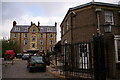
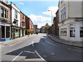
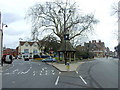
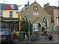
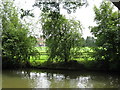
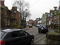
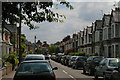
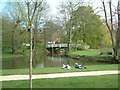
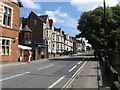
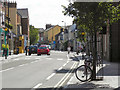
Photos of OX4 1JZ


Area Information
OX4 1JZ represents a specific postcode cluster within Oxfordshire, situated in a country home to significant population centres. With a resident population of 1,351, this area functions as a small, concentrated residential pocket rather than a sprawling neighbourhood. You enter a setting defined by its compact scale, where every household is within a short walking distance of most immediate needs. The environment caters primarily to a young demographic, distinguishing it from the older, more established communities often found in historic cities like Oxford. Daily life in OX4 1JZ revolves around convenience and proximity to the wider region. Although the postcode covers a limited footprint, it provides direct access to major retail chains and rail links that connect you to Oxford and beyond. There are no planning constraints here, meaning the area is free from the restrictions found near protected woodlands or national beautification sites. Instead, you face a straightforward reality: a mid-range crime risk that requires standard security awareness. Living in OX4 1JZ offers a straightforward trade-off, providing easy transport access and essential services while requiring residents to remain vigilant regarding local safety conditions. The area is practical, accessible, and focused on the needs of a young, largely renting household.
- Area Type
- Postcode
- Area Size
- Not available
- Population
- 1351
- Population Density
- 4058 people/km²
The property market in OX4 1JZ is characterised by a heavy reliance on renting rather than ownership. With only 31% of residents combining to own their homes, you are more likely to find long-term tenancies than family properties passed down through generations. The accommodation type is almost entirely houses, which offers privacy and space that high-density apartments or flats often lack. This housing stock appeals to young professionals and families who value detached living within a small town setting. Buying a home here presents a specific challenge given the low ownership rate. The market reflects a community where many residents are likely tenants of larger housing providers or individual landlords. For those looking to purchase, the scarcity of owner-occupied homes limits stock availability, meaning you may have to look further afield. However, the prevalence of houses ensures that existing homes generally meet standards for space and garden access. Homes in OX4 1JZ are situated in a property cluster that prioritises accessibility over exclusivity. The low barrier to entry for renting is balanced by the difficulty of finding owner-occupied properties. If you are a buyer, expect a competitive market where the majority of transactions occur on the rental side of the equation. The housing stock is practical, designed to support the young adult population that comprises the bulk of the 1,351 residents.
House Prices in OX4 1JZ
No properties found in this postcode.
Energy Efficiency in OX4 1JZ
Daily life in OX4 1JZ is defined by convenience, with five major retail outlets located within practical reach. Sainsburys Oxford, Tesco Oxford, and Co-op Cowley are the largest among these, ensuring you can stock up on groceries without travelling far. The presence of three railway stations adds to this convenience, with Oxford Parkway Railway Station, Radley Railway Station, and Islip Railway Station all offering transport options. There is no shortage of essential amenities for the 1,351 residents living here. You can access a wide variety of food choices at these retail giants, eliminating the need for long journeys to the city centre for basic shopping. Transport links mean you can reach wider leisure destinations quickly, though the immediate area focuses on functional retail. The lack of complex planning constraints like AONB status or protected woodlands means the built environment remains practical and unchanged. You will find that lifestyle here is practical and accessible. Commuters appreciate the rail links, while shoppers value the proximity of Co-op Cowley, Sainsburys Oxford, and Tesco Oxford. The area serves as a functional hub where daily needs are met without the noise of a larger city centre. Living in OX4 1JZ offers a balance of quiet residential life and easy access to the wider Oxford region.
Amenities
Schools
Families moving to OX4 1JZ have access to a mix of state and independent educational institutions within practical reach. East Oxford Primary School stands out as a state primary option holding a "good" Ofsted rating. This represents a solid foundation for younger children seeking a mainstream education with recognised standards. For those seeking independent education, Oxford International College is available nearby. However, you must note that this school currently holds an "inadequate" Ofsted rating. Families hoping for top-tier independent education should weigh this fact carefully before deciding. The presence of an independent school indicates a demand for diverse educational choices, yet the rating suggests caution is required for parents relying on this specific provider. The school mix in OX4 1JZ is small and selective. You do not have access to a large network of secondary options in the immediate postcode, meaning families may need to commute further for older children. The single primary school option with a positive rating provides a clear choice for local residents. When planning for a family, the "good" rating of East Oxford Primary School is the most reliable data point for assessing local educational quality.
| Rank | School | Type | Entry gender | Ages |
|---|
Explore more schools in this area
Go to Schools tabDemographics
The community in OX4 1JZ is distinctly young, with a median age of just 22 years. The most common age group consists of young adults between 15 and 29 years old, creating a neighbourhood where students and early career professionals form the backbone of society. This youthful profile influences the entire character of the area, shaping everything from local spending habits to social activities. Home ownership remains low at 31%, indicating that the majority of residents are tenants rather than landlords. This suggests a rental market where people are likely renting for educational pursuits or as a stepping stone to independence. The accommodation is almost exclusively comprised of houses, providing distinct boundaries and private gardens despite the high density of tenant households. While white residents make up the predominant ethnic group, the presence of young adults suggests a steady influx of new faces and cultures. You will find that this demographic cluster creates a lively, transient atmosphere. The low number of family owners means there are fewer grandparents in the immediate vicinity, yet the high concentration of young people generates a vibrant energy. Data regarding deprivation is not provided in this profile, but the home ownership figure hints at an area where financial barriers may limit long-term settlement. Lives here are often mobile and forward-looking, focused on careers and education rather than permanent roots.
Household Size
Accommodation Type
Tenure
Ethnic Group
Religion
Household Composition
Age
Household Deprivation
NS-SEC
Explore more demographic insights in this area
Go to Demographics tabPlanning
Planning Constraints
- Flood RiskPremium
- Ramsar Wetland SitesPremium
- Area of Outstanding Natural BeautyPremium
- Protected Nature ReservePremium
- Protected WoodlandPremium