Area Overview for OX4 1EA
Photos of OX4 1EA
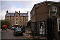
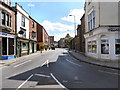
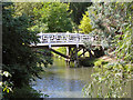
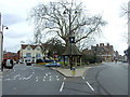
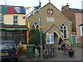
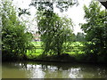
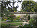
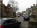
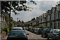
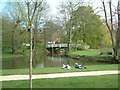
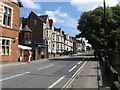
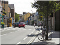
100 photos from this area
Area Information
Key information about the OX4 1EA including its size, population, and administrative classification.
- Area Type
- Postcode
- Area Size
- 1.3 hectares
- Population
- 1775
- Population Density
- 6591 people/km²
House Prices in OX4 1EA
61
Properties
£724,688
Average Sold Price
£277,500
Lowest Price
£1,100,000
Highest Price
Showing 61 properties
| Address | Type | Beds | Baths | Last Sale Price | Last Sale Date | |
|---|---|---|---|---|---|---|
| 25 Iffley Road, Oxford, OX4 1EA | Terraced | 4 | 2 | £730,000 | Dec 2017 | |
| 39 Iffley Road, Oxford, OX4 1EA | house | 9 | 2 | £1,100,000 | Jun 2016 | |
| 41 Iffley Road, Oxford, OX4 1EA | university_college | - | - | £1,100,000 | Jun 2016 | |
| 1 Iffley Road, Oxford, OX4 1EA | Terraced | 5 | - | £790,000 | Mar 2016 | |
| 37 Iffley Road, Oxford, OX4 1EA | house | 7 | 2 | £645,000 | Jun 2014 | |
| 11 Iffley Road, Oxford, OX4 1EA | house | - | - | £575,000 | Apr 2014 | |
| 29 Iffley Road, Oxford, OX4 1EA | Terraced | 4 | 3 | £580,000 | Jan 2013 | |
| 21 Iffley Road, Oxford, OX4 1EA | Terraced | - | - | £277,500 | Nov 1999 | |
| Basement Flat, 1 Iffley Road, Oxford, OX4 1EA | Flat | 4 | 2 | - | - | |
| 9 Iffley Road, Oxford, OX4 1EA | Terraced | 6 | 4 | - | - |
Page 1 of 7
Energy Efficiency in OX4 1EA
Amenities
Schools
| Rank | School | Type | Entry gender | Ages |
|---|
Explore more schools in this area
Go to Schools tabDemographics
Household Size
One person
most common
Accommodation Type
Houses
most common
Tenure
24
majority
Ethnic Group
White
most common
Religion
N/A
most common
Household Composition
N/A
most common
Age
22
median
Young Adults (15-29 years)
most common
Household Deprivation
N/A
with no deprivation
NS-SEC
19
in Lower managerial occupations
Explore more demographic insights in this area
Go to Demographics tabPlanning
Planning Constraints
- Flood RiskPremium
- Ramsar Wetland SitesPremium
- Area of Outstanding Natural BeautyPremium
- Protected Nature ReservePremium
- Protected WoodlandPremium