Area Overview for OX39 4TU
Photos of OX39 4TU

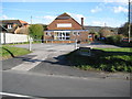
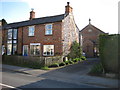
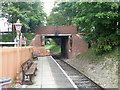

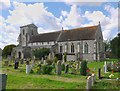


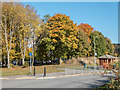
100 photos from this area
Area Information
Key information about the OX39 4TU including its size, population, and administrative classification.
- Area Type
- Postcode
- Area Size
- 5534 m²
- Population
- 1399
- Population Density
- 4582 people/km²
House Prices in OX39 4TU
18
Properties
£264,322
Average Sold Price
£114,500
Lowest Price
£462,000
Highest Price
Showing 18 properties
| Address | Type | Beds | Baths | Last Sale Price | Last Sale Date | |
|---|---|---|---|---|---|---|
| 11 Benwells, Chinnor, OX39 4TU | Detached | 3 | 1 | £462,000 | Aug 2024 | |
| 3 Benwells, Chinnor, OX39 4TU | Semi-detached | 3 | 1 | £395,000 | Jan 2023 | |
| 13 Benwells, Chinnor, OX39 4TU | Semi-detached | 3 | 1 | £322,500 | Dec 2019 | |
| 2A Benwells, Chinnor, OX39 4TU | Semi-detached | 3 | 2 | £305,000 | Jan 2019 | |
| 9 Benwells, Chinnor, OX39 4TU | Detached | 3 | - | £317,000 | Feb 2015 | |
| 10 Benwells, Chinnor, OX39 4TU | Semi-detached | - | - | £261,001 | Jun 2014 | |
| 15 Benwells, Chinnor, OX39 4TU | house | - | - | £242,000 | Nov 2011 | |
| 4 Benwells, Chinnor, OX39 4TU | Semi-detached | 3 | 2 | £247,500 | Mar 2010 | |
| 5 Benwells, Chinnor, OX39 4TU | house | - | - | £210,000 | Aug 2009 | |
| 8 Benwells, Chinnor, OX39 4TU | Detached | 3 | 1 | £225,000 | Jan 2006 |
Page 1 of 2
Energy Efficiency in OX39 4TU
Amenities
Schools
| Rank | School | Type | Entry gender | Ages |
|---|
Explore more schools in this area
Go to Schools tabDemographics
Household Size
Family (3-5 people)
most common
Accommodation Type
Houses
most common
Tenure
85
majority
Ethnic Group
White
most common
Religion
N/A
most common
Household Composition
N/A
most common
Age
47
median
Adults (30-64 years)
most common
Household Deprivation
N/A
with no deprivation
NS-SEC
40
in Lower managerial occupations
Explore more demographic insights in this area
Go to Demographics tabPlanning
Planning Constraints
- Flood RiskPremium
- Ramsar Wetland SitesPremium
- Area of Outstanding Natural BeautyPremium
- Protected Nature ReservePremium
- Protected WoodlandPremium