Area Overview for OX39 4FN
Photos of OX39 4FN
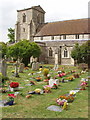
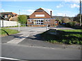
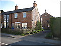
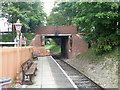


100 photos from this area
Area Information
Key information about the OX39 4FN including its size, population, and administrative classification.
- Area Type
- Postcode
- Area Size
- 1.4 hectares
- Population
- 2583
- Population Density
- 658 people/km²
House Prices in OX39 4FN
35
Properties
£447,231
Average Sold Price
£158,000
Lowest Price
£760,000
Highest Price
Showing 35 properties
| Address | Type | Beds | Baths | Last Sale Price | Last Sale Date | |
|---|---|---|---|---|---|---|
| 45 Barley Rye, Chinnor, OX39 4FN | Semi-detached | 2 | 1 | £335,000 | Jul 2024 | |
| 6 Barley Rye, Chinnor, OX39 4FN | Detached | 3 | 2 | £420,000 | May 2024 | |
| 15 Barley Rye, Chinnor, OX39 4FN | Retail | 4 | 3 | £760,000 | Sep 2022 | |
| 14 Barley Rye, Chinnor, OX39 4FN | Terraced | 3 | 1 | £158,000 | Nov 2021 | |
| 10 Barley Rye, Chinnor, OX39 4FN | Terraced | 2 | 1 | £162,500 | Oct 2021 | |
| 23 Barley Rye, Chinnor, OX39 4FN | Detached | 2 | 1 | £499,000 | Jun 2019 | |
| 19 Barley Rye, Chinnor, OX39 4FN | house | - | - | £575,000 | Jun 2019 | |
| 21 Barley Rye, Chinnor, OX39 4FN | house | - | - | £580,000 | Jun 2019 | |
| 17 Barley Rye, Chinnor, OX39 4FN | house | - | - | £565,000 | Jun 2019 | |
| 25 Barley Rye, Chinnor, OX39 4FN | house | - | - | £390,000 | Feb 2019 |
Page 1 of 4
Energy Efficiency in OX39 4FN
Amenities
Schools
| Rank | School | Type | Entry gender | Ages |
|---|
Explore more schools in this area
Go to Schools tabDemographics
Household Size
Family (3-5 people)
most common
Accommodation Type
Houses
most common
Tenure
74
majority
Ethnic Group
White
most common
Religion
N/A
most common
Household Composition
N/A
most common
Age
47
median
Adults (30-64 years)
most common
Household Deprivation
N/A
with no deprivation
NS-SEC
43
in Lower managerial occupations
Explore more demographic insights in this area
Go to Demographics tabPlanning
Planning Constraints
- Flood RiskPremium
- Ramsar Wetland SitesPremium
- Area of Outstanding Natural BeautyPremium
- Protected Nature ReservePremium
- Protected WoodlandPremium