Area Overview for OX39 4BH
Photos of OX39 4BH
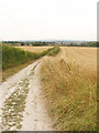
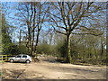
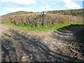
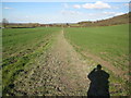
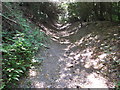
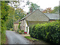


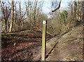
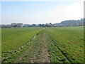
28 photos from this area
Area Information
Key information about the OX39 4BH including its size, population, and administrative classification.
- Area Type
- Postcode
- Area Size
- 54.2 hectares
- Population
- 1542
- Population Density
- 72 people/km²
House Prices in OX39 4BH
21
Properties
£1,209,963
Average Sold Price
£360,000
Lowest Price
£4,000,000
Highest Price
Showing 21 properties
| Address | Type | Beds | Baths | Last Sale Price | Last Sale Date | |
|---|---|---|---|---|---|---|
| Tanglewood, Hill Top Lane, Chinnor, OX39 4BH | house | 5 | 3 | £1,400,000 | Oct 2022 | |
| Great Wood House, Hill Top Lane, Chinnor, OX39 4BH | house | - | - | £2,000,000 | Jul 2022 | |
| Campions Hill, Hill Top Lane, Chinnor, OX39 4BH | house | 4 | - | £4,000,000 | Apr 2021 | |
| Woodland Ridge, Hill Top Lane, Chinnor, OX39 4BH | Detached | 5 | 2 | £875,000 | Jan 2020 | |
| Foresters Cottage, Hill Top Lane, Chinnor, OX39 4BH | house | - | - | £1,290,000 | Oct 2015 | |
| Cherry Orchard, Hill Top Lane, Chinnor, OX39 4BH | Detached | 6 | 4 | £1,200,000 | Nov 2014 | |
| Dragons Mount, Hill Top Lane, Chinnor, OX39 4BH | house | 6 | - | £1,225,000 | Aug 2014 | |
| 2, Hill Top Cottages, Hill Top Lane, Chinnor, OX39 4BH | Detached | - | - | £395,050 | Sep 2009 | |
| 1, Hill Top Cottages, Hill Top Lane, Chinnor, OX39 4BH | Detached | - | - | £360,000 | May 2003 | |
| High Acres, Hill Top Lane, Chinnor, OX39 4BH | house | 5 | - | £871,000 | Nov 2002 |
Page 1 of 3
Energy Efficiency in OX39 4BH
Amenities
Schools
| Rank | School | Type | Entry gender | Ages |
|---|
Explore more schools in this area
Go to Schools tabDemographics
Household Size
Two person
most common
Accommodation Type
Houses
most common
Tenure
82
majority
Ethnic Group
White
most common
Religion
N/A
most common
Household Composition
N/A
most common
Age
47
median
Adults (30-64 years)
most common
Household Deprivation
N/A
with no deprivation
NS-SEC
46
in Lower managerial occupations
Explore more demographic insights in this area
Go to Demographics tabPlanning
Planning Constraints
- Flood RiskPremium
- Ramsar Wetland SitesPremium
- Area of Outstanding Natural BeautyPremium
- Protected Nature ReservePremium
- Protected WoodlandPremium