Area Overview for OX39 4AH
Photos of OX39 4AH
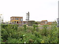

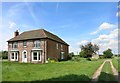
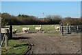
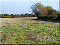
5 photos from this area
Area Information
Key information about the OX39 4AH including its size, population, and administrative classification.
- Area Type
- Postcode
- Area Size
- 74.4 hectares
- Population
- 1856
- Population Density
- 212 people/km²
House Prices in OX39 4AH
13
Properties
£990,417
Average Sold Price
£227,500
Lowest Price
£1,385,000
Highest Price
Showing 13 properties
| Address | Type | Beds | Baths | Last Sale Price | Last Sale Date | |
|---|---|---|---|---|---|---|
| Willows, Road Running Through Henton, Henton, Chinnor, OX39 4AH | Detached | 5 | 2 | £1,250,000 | Jul 2025 | |
| Old Dairy, Road Running Through Henton, Henton, Chinnor, OX39 4AH | house | - | - | £1,375,000 | Dec 2022 | |
| Kynama, Road Running Through Henton, Henton, Chinnor, OX39 4AH | house | - | - | £1,385,000 | Mar 2022 | |
| Rowan Farm, Road Running Through Henton, Henton, Chinnor, OX39 4AH | house | - | - | £1,250,000 | Sep 2018 | |
| Henton Barn, Road Running Through Henton, Henton, Chinnor, OX39 4AH | house | - | - | £455,000 | Aug 2003 | |
| Home Farm House, Road Running Through Henton, Henton, Chinnor, OX39 4AH | Semi-detached | - | - | £227,500 | Apr 1995 | |
| Bumble Cottage, 10 Road Running Through Henton, Henton, Chinnor, OX39 4AH | Detached | 3 | - | - | - | |
| 11 ROAD RUNNING THROUGH HENTON, Henton, Chinnor, OX39 4AH | Semi-detached | - | - | - | - | |
| Elm End House, Road Running Through Henton, Henton, Chinnor, OX39 4AH | house | - | - | - | - | |
| 9 Road Running Through Henton, Henton, Chinnor, OX39 4AH | Detached | - | - | - | - |
Page 1 of 2
Energy Efficiency in OX39 4AH
Amenities
Schools
| Rank | School | Type | Entry gender | Ages |
|---|
Explore more schools in this area
Go to Schools tabDemographics
Household Size
Two person
most common
Accommodation Type
Houses
most common
Tenure
84
majority
Ethnic Group
White
most common
Religion
N/A
most common
Household Composition
N/A
most common
Age
47
median
Adults (30-64 years)
most common
Household Deprivation
N/A
with no deprivation
NS-SEC
44
in Lower managerial occupations
Explore more demographic insights in this area
Go to Demographics tabPlanning
Planning Constraints
- Flood RiskPremium
- Ramsar Wetland SitesPremium
- Area of Outstanding Natural BeautyPremium
- Protected Nature ReservePremium
- Protected WoodlandPremium