Area Overview for OX39 4AA
Photos of OX39 4AA
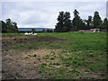
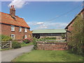


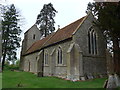
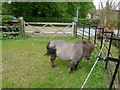
14 photos from this area
Area Information
Key information about the OX39 4AA including its size, population, and administrative classification.
- Area Type
- Postcode
- Area Size
- 1.6 km²
- Population
- 1856
- Population Density
- 212 people/km²
House Prices in OX39 4AA
19
Properties
£682,500
Average Sold Price
£500,000
Lowest Price
£1,100,000
Highest Price
Showing 19 properties
| Address | Type | Beds | Baths | Last Sale Price | Last Sale Date | |
|---|---|---|---|---|---|---|
| Lane End House, Access Road To Emmington, Emmington, Chinnor, OX39 4AA | Detached | 5 | 3 | £1,100,000 | Mar 2018 | |
| Mole Cottage, 6 Access Road To Emmington, Emmington, Chinnor, OX39 4AA | Semi-detached | 4 | 2 | £610,000 | Sep 2014 | |
| Tigh Darach, Access Road To Emmington, Emmington, Chinnor, OX39 4AA | Semi-detached | 3 | 3 | £500,000 | Jun 2010 | |
| The Old Rectory, Access Road To Emmington, Emmington, Chinnor, OX39 4AA | Detached | - | - | £520,000 | Aug 1998 | |
| 7 Access Road To Emmington, Emmington, Chinnor, OX39 4AA | Semi-detached | 3 | 1 | - | - | |
| Mulberry Manor, Access Road To Emmington, Emmington, Chinnor, OX39 4AA | Semi-detached | 3 | - | - | - | |
| Conker Corner, Access Road To Emmington, Emmington, Chinnor, OX39 4AA | house | - | - | - | - | |
| Elm Barn, Manor Farm, Access Road To Emmington, Emmington, Chinnor, OX39 4AA | Semi-detached | 2 | 1 | - | - | |
| Two Chestnuts, Access Road To Emmington, Emmington, Chinnor, OX39 4AA | Detached | - | - | - | - | |
| Village Farm, Access Road To Emmington, Emmington, Chinnor, OX39 4AA | Detached | - | - | - | - |
Page 1 of 2
Energy Efficiency in OX39 4AA
Amenities
Schools
| Rank | School | Type | Entry gender | Ages |
|---|
Explore more schools in this area
Go to Schools tabDemographics
Household Size
Two person
most common
Accommodation Type
Houses
most common
Tenure
84
majority
Ethnic Group
White
most common
Religion
N/A
most common
Household Composition
N/A
most common
Age
47
median
Adults (30-64 years)
most common
Household Deprivation
N/A
with no deprivation
NS-SEC
44
in Lower managerial occupations
Explore more demographic insights in this area
Go to Demographics tabPlanning
Planning Constraints
- Flood RiskPremium
- Ramsar Wetland SitesPremium
- Area of Outstanding Natural BeautyPremium
- Protected Nature ReservePremium
- Protected WoodlandPremium