Area Overview for OX33 1RY
Photos of OX33 1RY
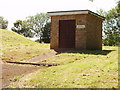
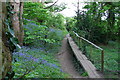
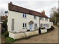
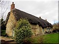
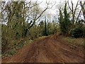
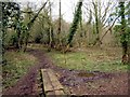
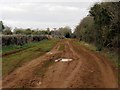
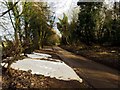

41 photos from this area
Area Information
Key information about the OX33 1RY including its size, population, and administrative classification.
- Area Type
- Postcode
- Area Size
- 3.3 hectares
- Population
- 1467
- Population Density
- 315 people/km²
House Prices in OX33 1RY
26
Properties
£272,992
Average Sold Price
£79,000
Lowest Price
£485,000
Highest Price
Showing 26 properties
| Address | Type | Beds | Baths | Last Sale Price | Last Sale Date | |
|---|---|---|---|---|---|---|
| Dolce Domum, 15 Blenheim Road, Horspath, Oxford, OX33 1RY | Bungalow | 3 | - | £320,000 | Sep 2019 | |
| 24 Blenheim Road, Horspath, Oxford, OX33 1RY | Detached | 3 | 1 | £449,950 | Aug 2018 | |
| Blenheim House, 19 Blenheim Road, Horspath, Oxford, OX33 1RY | Detached | 4 | 1 | £485,000 | Aug 2018 | |
| 14 Blenheim Road, Horspath, Oxford, OX33 1RY | Bungalow | 3 | 1 | £470,000 | Dec 2017 | |
| 10 Blenheim Road, Horspath, Oxford, OX33 1RY | Detached | - | - | £325,000 | Apr 2006 | |
| Fitzwilliam House, 23 Blenheim Road, Horspath, Oxford, OX33 1RY | Semi-detached | - | - | £186,000 | Jul 2004 | |
| 11 Blenheim Road, Horspath, Oxford, OX33 1RY | Bungalow | - | - | £249,950 | Jun 2002 | |
| 17 Blenheim Road, Horspath, Oxford, OX33 1RY | Detached | - | - | £248,000 | Nov 2001 | |
| 12 Blenheim Road, Horspath, Oxford, OX33 1RY | Detached | - | - | £151,000 | Nov 1998 | |
| 16 Blenheim Road, Horspath, Oxford, OX33 1RY | Detached | - | - | £162,000 | Aug 1998 |
Page 1 of 3
Energy Efficiency in OX33 1RY
Amenities
Schools
| Rank | School | Type | Entry gender | Ages |
|---|
Explore more schools in this area
Go to Schools tabDemographics
Household Size
Two person
most common
Accommodation Type
Houses
most common
Tenure
87
majority
Ethnic Group
White
most common
Religion
N/A
most common
Household Composition
N/A
most common
Age
47
median
Adults (30-64 years)
most common
Household Deprivation
N/A
with no deprivation
NS-SEC
39
in Lower managerial occupations
Explore more demographic insights in this area
Go to Demographics tabPlanning
Planning Constraints
- Flood RiskPremium
- Ramsar Wetland SitesPremium
- Area of Outstanding Natural BeautyPremium
- Protected Nature ReservePremium
- Protected WoodlandPremium