Area Overview for OX33 1PZ
Photos of OX33 1PZ
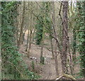


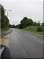
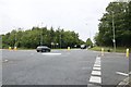


34 photos from this area
Area Information
Key information about the OX33 1PZ including its size, population, and administrative classification.
- Area Type
- Postcode
- Area Size
- 10.4 hectares
- Population
- 1492
- Population Density
- 106 people/km²
House Prices in OX33 1PZ
21
Properties
£498,900
Average Sold Price
£300,000
Lowest Price
£610,000
Highest Price
Showing 21 properties
| Address | Type | Beds | Baths | Last Sale Price | Last Sale Date | |
|---|---|---|---|---|---|---|
| The Old Bakehouse, Road Passing Wheatley Park School, Holton, Oxford, OX33 1PZ | Cottage | 5 | - | £572,000 | Jul 2017 | |
| Greythorpe Haven, Road Passing Wheatley Park School, Holton, Oxford, OX33 1PZ | house | - | - | £582,500 | Jul 2012 | |
| High Bank, Road Passing Wheatley Park School, Holton, Oxford, OX33 1PZ | house | 4 | - | £610,000 | Jul 2010 | |
| Poplar Mead, Road Passing Wheatley Park School, Holton, Oxford, OX33 1PZ | Bungalow | 1 | 1 | £300,000 | Nov 2009 | |
| Holly Hurst, Road Passing Wheatley Park School, Holton, Oxford, OX33 1PZ | Detached | - | - | £430,000 | Jul 2006 | |
| Leafield House, Road Passing Wheatley Park School, Holton, Oxford, OX33 1PZ | Detached | 4 | 2 | - | - | |
| Trindles, Road Passing Wheatley Park School, Holton, Oxford, OX33 1PZ | Detached | 4 | 2 | - | - | |
| Lochturffin, Road Passing Wheatley Park School, Holton, Oxford, OX33 1PZ | Detached | 5 | - | - | - | |
| Shielings, Road Passing Wheatley Park School, Holton, Oxford, OX33 1PZ | house | 4 | - | - | - | |
| Simthian House, Road Passing Wheatley Park School, Holton, Oxford, OX33 1PZ | Detached | - | - | - | - |
Page 1 of 3
Energy Efficiency in OX33 1PZ
Amenities
Schools
| Rank | School | Type | Entry gender | Ages |
|---|
Explore more schools in this area
Go to Schools tabDemographics
Household Size
Family (3-5 people)
most common
Accommodation Type
Houses
most common
Tenure
70
majority
Ethnic Group
White
most common
Religion
N/A
most common
Household Composition
N/A
most common
Age
47
median
Adults (30-64 years)
most common
Household Deprivation
N/A
with no deprivation
NS-SEC
41
in Lower managerial occupations
Explore more demographic insights in this area
Go to Demographics tabPlanning
Planning Constraints
- Flood RiskPremium
- Ramsar Wetland SitesPremium
- Area of Outstanding Natural BeautyPremium
- Protected Nature ReservePremium
- Protected WoodlandPremium