Area Overview for OX33 1NL
Photos of OX33 1NL
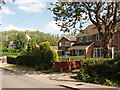
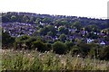

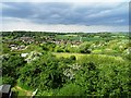
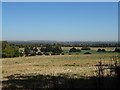
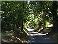
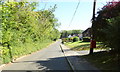
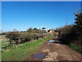
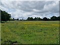
43 photos from this area
Area Information
Key information about the OX33 1NL including its size, population, and administrative classification.
- Area Type
- Postcode
- Area Size
- 2.6 hectares
- Population
- 1301
- Population Density
- 899 people/km²
House Prices in OX33 1NL
42
Properties
£473,640
Average Sold Price
£188,000
Lowest Price
£725,000
Highest Price
Showing 42 properties
| Address | Type | Beds | Baths | Last Sale Price | Last Sale Date | |
|---|---|---|---|---|---|---|
| 13 Barlow Close, Wheatley, Oxford, OX33 1NL | Detached | 4 | 2 | £575,000 | Feb 2025 | |
| 17 Barlow Close, Wheatley, Oxford, OX33 1NL | Semi-detached | 4 | 1 | £510,000 | Jun 2024 | |
| 22 Barlow Close, Wheatley, Oxford, OX33 1NL | Detached | 5 | 3 | £645,000 | Jun 2024 | |
| 24 Barlow Close, Wheatley, Oxford, OX33 1NL | Detached | 4 | 3 | £665,000 | Jan 2023 | |
| 34 Barlow Close, Wheatley, Oxford, OX33 1NL | Land | - | - | £725,000 | Sep 2022 | |
| 3 Barlow Close, Wheatley, Oxford, OX33 1NL | Detached | 4 | - | £550,000 | Dec 2020 | |
| 4 Barlow Close, Wheatley, Oxford, OX33 1NL | house | - | - | £475,000 | Oct 2020 | |
| 31 Barlow Close, Wheatley, Oxford, OX33 1NL | Detached | 5 | 2 | £660,000 | Jan 2020 | |
| 18 Barlow Close, Wheatley, Oxford, OX33 1NL | Detached | 4 | 1 | £420,000 | Apr 2019 | |
| 21 Barlow Close, Wheatley, Oxford, OX33 1NL | Detached | 4 | - | £470,000 | Feb 2019 |
Page 1 of 5
Energy Efficiency in OX33 1NL
Amenities
Schools
| Rank | School | Type | Entry gender | Ages |
|---|
Explore more schools in this area
Go to Schools tabDemographics
Household Size
Two person
most common
Accommodation Type
Houses
most common
Tenure
88
majority
Ethnic Group
White
most common
Religion
N/A
most common
Household Composition
N/A
most common
Age
47
median
Adults (30-64 years)
most common
Household Deprivation
N/A
with no deprivation
NS-SEC
48
in Lower managerial occupations
Explore more demographic insights in this area
Go to Demographics tabPlanning
Planning Constraints
- Flood RiskPremium
- Ramsar Wetland SitesPremium
- Area of Outstanding Natural BeautyPremium
- Protected Nature ReservePremium
- Protected WoodlandPremium