Area Overview for OX33 1BG
Photos of OX33 1BG
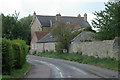
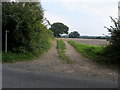
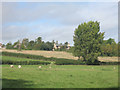
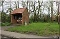
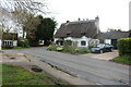
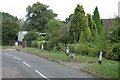
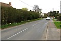


10 photos from this area
Area Information
Key information about the OX33 1BG including its size, population, and administrative classification.
- Area Type
- Postcode
- Area Size
- 6.9 hectares
- Population
- 1222
- Population Density
- 35 people/km²
House Prices in OX33 1BG
12
Properties
£394,050
Average Sold Price
£153,000
Lowest Price
£700,000
Highest Price
Showing 12 properties
| Address | Type | Beds | Baths | Last Sale Price | Last Sale Date | |
|---|---|---|---|---|---|---|
| Willow Cottage, Oakley Road, Horton Cum Studley, OX33 1BG | house | 3 | 1 | £206,250 | Nov 2020 | |
| Oakwood, Oakley Road, Horton Cum Studley, OX33 1BG | house | - | - | £700,000 | Jun 2018 | |
| Kimmeridge, Oakley Road, Horton Cum Studley, OX33 1BG | Detached | - | - | £451,000 | Sep 2012 | |
| Walnut Tree House, Oakley Road, Horton Cum Studley, OX33 1BG | house | - | - | £460,000 | Sep 2009 | |
| Oak Hill, Oakley Road, Horton Cum Studley, OX33 1BG | house | - | - | £153,000 | Nov 1999 | |
| Barnside, Oakley Road, Horton Cum Studley, OX33 1BG | Detached | - | - | - | - | |
| The Old Dairy, Manor Farm, Oakley Road, Horton Cum Studley, OX33 1BG | Office | - | - | - | - | |
| Unit 1, Corner Farm Industrial Estate, Oakley Road, Horton Cum Studley, OX33 1BG | Office | - | - | - | - | |
| Kirtlands, Oakley Road, Horton Cum Studley, OX33 1BG | Semi-detached | - | - | - | - | |
| Purbeck, Oakley Road, Horton Cum Studley, OX33 1BG | Semi-detached | - | - | - | - |
Page 1 of 2
Energy Efficiency in OX33 1BG
Amenities
Schools
| Rank | School | Type | Entry gender | Ages |
|---|
Explore more schools in this area
Go to Schools tabDemographics
Household Size
Two person
most common
Accommodation Type
Houses
most common
Tenure
84
majority
Ethnic Group
White
most common
Religion
N/A
most common
Household Composition
N/A
most common
Age
47
median
Adults (30-64 years)
most common
Household Deprivation
N/A
with no deprivation
NS-SEC
49
in Lower managerial occupations
Explore more demographic insights in this area
Go to Demographics tabPlanning
Planning Constraints
- Flood RiskPremium
- Ramsar Wetland SitesPremium
- Area of Outstanding Natural BeautyPremium
- Protected Nature ReservePremium
- Protected WoodlandPremium