Area Overview for OX3 9TT
Photos of OX3 9TT
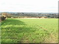
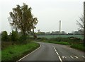
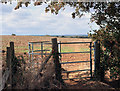
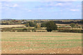
10 photos from this area
Area Information
Key information about the OX3 9TT including its size, population, and administrative classification.
- Area Type
- Postcode
- Area Size
- 78.0 hectares
- Population
- 1222
- Population Density
- 35 people/km²
House Prices in OX3 9TT
20
Properties
£1,432,750
Average Sold Price
£86,500
Lowest Price
£4,900,000
Highest Price
Showing 20 properties
| Address | Type | Beds | Baths | Last Sale Price | Last Sale Date | |
|---|---|---|---|---|---|---|
| The Old Rectory, Street Through Noke, Noke, OX3 9TT | house | - | - | £4,900,000 | Mar 2020 | |
| Hillside, Street Through Noke, Noke, OX3 9TT | Detached | 5 | 4 | £2,450,000 | Jun 2016 | |
| The Plough, Street Through Noke, Noke, OX3 9TT | Cottage | 3 | - | £630,000 | Mar 2014 | |
| Willow Tree House, Street Through Noke, Noke, OX3 9TT | Detached | 7 | 5 | £86,500 | Aug 2010 | |
| Little Warren, Street Through Noke, Noke, OX3 9TT | house | - | - | £250,000 | Feb 2010 | |
| Manor Farm Cottage, Street Through Noke, Noke, OX3 9TT | house | - | - | £280,000 | May 2008 | |
| Mandray, Street Through Noke, Noke, OX3 9TT | Detached | 2 | - | - | - | |
| New Cottage, Street Through Noke, Noke, OX3 9TT | Detached | 4 | 2 | - | - | |
| Quarry Bank, Street Through Noke, Noke, OX3 9TT | Bungalow | 3 | - | - | - | |
| Winwood, Street Through Noke, Noke, OX3 9TT | house | - | - | - | - |
Page 1 of 2
Energy Efficiency in OX3 9TT
Amenities
Schools
| Rank | School | Type | Entry gender | Ages |
|---|
Explore more schools in this area
Go to Schools tabDemographics
Household Size
Two person
most common
Accommodation Type
Houses
most common
Tenure
84
majority
Ethnic Group
White
most common
Religion
N/A
most common
Household Composition
N/A
most common
Age
47
median
Adults (30-64 years)
most common
Household Deprivation
N/A
with no deprivation
NS-SEC
49
in Lower managerial occupations
Explore more demographic insights in this area
Go to Demographics tabPlanning
Planning Constraints
- Flood RiskPremium
- Ramsar Wetland SitesPremium
- Area of Outstanding Natural BeautyPremium
- Protected Nature ReservePremium
- Protected WoodlandPremium