Area Overview for OX3 9JA
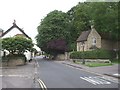
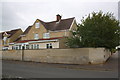
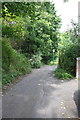
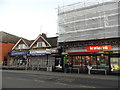
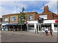
Photos of OX3 9JA


Area Information
OX3 9JA represents a compact residential cluster covering just 1.9 hectares, yet it accommodates a significant population of 2,416 people. This density results in an exceptionally high population figure of 130,051 people per square kilometre, indicating a tightly packed urban environment typical of Oxfordshire suburbs. You are buying into a specific postcode area where space is at a premium and neighbours are inevitably close by. The layout focuses almost entirely on housing, creating a community where daily interactions are frequent and the streetscape is dominated by domestic architecture. Living in OX3 9JA means navigating a neighbourhood defined by its density rather than sprawling green belts. The high population per unit of land suggests a vibrant street life but also limits open space within the immediate cluster boundaries. Residents benefit from proximity to central Oxford and surrounding villages, yet the small physical footprint requires efficient use of land. This area caters to residents who prioritise location over garden size or row spacing. The environment is mature and established, reflecting a neighbourhood that has developed organically over time to serve a large number of households within a limited boundary. You get a concentrated slice of Oxfordshire life where comfort comes from connection to services rather than isolation within the postcode itself.
- Area Type
- Postcode
- Area Size
- 1.9 hectares
- Population
- 2416
- Population Density
- 3026 people/km²
Housing in OX3 9JA is characterised by a predominance of houses, creating a uniform market focused on home ownership and rental sectors. With 46% of residents being homeowners, the area maintains a balanced mix of private proprietors and tenants. This ownership statistic suggests the property market is neither exclusively buy-to-let nor purely private investment held, but rather a community of settled locals. The accommodation type is strictly houses, which means every offering will come with its own garden, driveway, and ground level access. You will not encounter conversion flats or apartment blocks within these boundaries. For buyers, this consistency simplifies property search but limits variety in architectural styles or price points based on unit type. The 46% ownership rate indicates strong historical retention of homes within the family structure, while the remaining 54% points to an active rental market or recent movers purchasing their first family home. The density of 130,051 people per square kilometre keeps property values competitive driven by high demand for space in a limited area. Investors seeking steady rental yields should note the stable age profile of adults aged 30 to 64 years, which often correlates with long-term tenancy. Families moving here will find the housing stock readily available, though competition may arise due to the small 1.9-hectare footprint.
House Prices in OX3 9JA
Showing 35 properties
| Address | Type | Beds | Baths | Last Sale Price | Last Sale Date | |
|---|---|---|---|---|---|---|
| 223 London Road, Headington, Oxford, OX3 9JA | Semi-detached | 5 | 1 | £500,000 | Nov 2019 | |
| 221 London Road, Headington, Oxford, OX3 9JA | Detached | 5 | 4 | £450,000 | Jul 2017 | |
| 211 London Road, Headington, Oxford, OX3 9JA | house | - | - | £250,000 | Jul 2011 | |
| 225 London Road, Headington, Oxford, OX3 9JA | Semi-detached | 5 | 2 | £249,500 | Jun 2007 | |
| 215 London Road, Headington, Oxford, OX3 9JA | Detached | 5 | 2 | £360,000 | Jul 2006 | |
| 217 London Road, Headington, Oxford, OX3 9JA | house | 5 | 2 | £100,000 | Aug 1998 | |
| 219 London Road, Headington, Oxford, OX3 9JA | Semi-detached | - | - | £115,000 | Aug 1998 | |
| 229 London Road, Headington, Oxford, OX3 9JA | Semi-detached | 4 | 1 | - | - | |
| Flat 2, Richmond Court, 249 London Road, Headington, Oxford, OX3 9JA | Flat | 2 | - | - | - | |
| 221 London Road, Headington, Oxford, OX3 9JA | Semi-detached | - | - | - | - |
Energy Efficiency in OX3 9JA
Living in OX3 9JA places you within striking distance of several key retail and transport hubs. Your nearest shopping options are located in adjacent Headington, where you can shop at Co-op Headington, Waitrose Headington, and Iceland Headington. These three major retailers offer full-range grocery supplies, specialist homeware, and fresh produce without the need for long car journeys. This retail trio provides comprehensive daily provisioning for all household needs. For commuting, three railway stations serve the wider locality: Oxford Parkway Railway Station, Islip Railway Station, and Radley Railway Station. These links connect you to the mainline network for travel to the city or surrounding villages. The concentration of five retail outlets and three active railway stations creates a lifestyle centred on convenience and efficiency. You do not need to travel far for essentials, yet you retain easy access to broader travel networks when required. The presence of Waitrose adds a premium grocery option if you prefer higher-end shopping experiences. Regular bus or train services to these stations ensure you can reach Oxford businesses or leisure destinations quickly. Daily life revolves around these accessible amenities, meaning you can run weekly errands locally while keeping bigger trips for weekends. This balance of local retail and regional rail access defines the practical character of home ownership here.
Amenities
Schools
Families considering OX3 9JA have access to Barton Park Primary School, which operates at a good Ofsted rating. This primary institution serves children before they move to secondary education elsewhere in the Oxford catchment area. The presence of a well-rated primary school is a practical priority for households with young children residing in the 30 to 64-year-old age range. No secondary schools are listed in the immediate data, meaning older children commute to larger hubs outside this small cluster. The single available option, Barton Park Primary School, confirms the area functions as a residential feeder community rather than a standalone educational hub. The good rating provides reassurance regarding academic standards and care for students entering the system. Parents in this postcode will rely heavily on this primary facility while focusing house searches on proximity to their home. The concentration of residents aged 30 to 64 years aligns well with school-age children, sustaining steady demand for this primary provision. While secondary options require further travel, the secured quality of primary education supports the area's appeal to younger families looking to settle permanently.
| Rank | School | Type | Entry gender | Ages |
|---|
Explore more schools in this area
Go to Schools tabDemographics
The community in OX3 9JA is dominated by adults between the ages of 30 and 64 years, with a median age of 47. This age profile reinforces the presence of families and established households rather than transient populations or younger single occupants. A substantial portion of residents are in their prime working years, contributing to a stable neighbourhood character. Homeownership stands at 46%, indicating a split market where slight majority of owners are balanced by a significant number of renters or shared ownership tenants. This ownership level reflects a mature area accessible to both buyers and long-term residents. The accommodation type is exclusively houses, meaning you will not find flats or apartments within this specific cluster. Every structure is a standalone or semi-detached home, catering to family living arrangements. The predominant ethnic group is White, aligning with the broader demographic makeup of the region. While 46% of homes are owned outright or via mortgage, the remainder suggests an active rental sector. These figures paint a picture of a settled community where life is domestic and family-centred. The absence of multi-unit housing options means privacy is inherent to the layout, even with the high population density. Buyers looking for traditional garden settings will find the entire area suits their requirements, supported by a resident base that has grown up in similar environments.
Household Size
Accommodation Type
Tenure
Ethnic Group
Religion
Household Composition
Age
Household Deprivation
NS-SEC
Explore more demographic insights in this area
Go to Demographics tabPlanning
Planning Constraints
- Flood RiskPremium
- Ramsar Wetland SitesPremium
- Area of Outstanding Natural BeautyPremium
- Protected Nature ReservePremium
- Protected WoodlandPremium