Area Overview for OX3 9FQ
Photos of OX3 9FQ
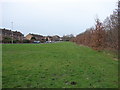
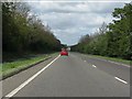
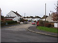
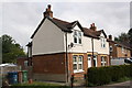
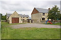
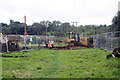
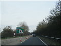
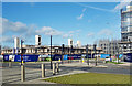
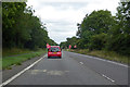
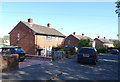
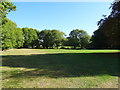
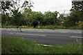
28 photos from this area
Area Information
Key information about the OX3 9FQ including its size, population, and administrative classification.
- Area Type
- Postcode
- Area Size
- 4.9 hectares
- Population
- 2416
- Population Density
- 3026 people/km²
House Prices in OX3 9FQ
55
Properties
£653,934
Average Sold Price
£555,000
Lowest Price
£810,000
Highest Price
Showing 55 properties
| Address | Type | Beds | Baths | Last Sale Price | Last Sale Date | |
|---|---|---|---|---|---|---|
| 2 Barton Fields Road, Oxford, OX3 9FQ | Terraced | 3 | 3 | £700,000 | Oct 2023 | |
| 10 Barton Fields Road, Oxford, OX3 9FQ | Terraced | 4 | 3 | £810,000 | Sep 2023 | |
| 51 Barton Fields Road, Oxford, OX3 9FQ | Semi-detached | 3 | 3 | £575,000 | Mar 2023 | |
| 9 Barton Fields Road, Oxford, OX3 9FQ | Terraced | 4 | 3 | £675,000 | Sep 2022 | |
| 65 Barton Fields Road, Oxford, OX3 9FQ | Flat | 2 | 2 | £579,950 | May 2021 | |
| 59 Barton Fields Road, Oxford, OX3 9FQ | house | - | - | £555,000 | Mar 2021 | |
| 49 Barton Fields Road, Oxford, OX3 9FQ | Terraced | 4 | - | £590,000 | Dec 2020 | |
| 63 Barton Fields Road, Oxford, OX3 9FQ | house | - | - | £569,950 | Dec 2020 | |
| 12 Barton Fields Road, Oxford, OX3 9FQ | Terraced | 4 | 3 | £675,000 | Nov 2020 | |
| 47 Barton Fields Road, Oxford, OX3 9FQ | house | - | - | £727,307 | Dec 2019 |
Page 1 of 6
Energy Efficiency in OX3 9FQ
Amenities
Schools
| Rank | School | Type | Entry gender | Ages |
|---|
Explore more schools in this area
Go to Schools tabDemographics
Household Size
Family (3-5 people)
most common
Accommodation Type
Houses
most common
Tenure
46
majority
Ethnic Group
White
most common
Religion
N/A
most common
Household Composition
N/A
most common
Age
47
median
Adults (30-64 years)
most common
Household Deprivation
N/A
with no deprivation
NS-SEC
39
in Lower managerial occupations
Explore more demographic insights in this area
Go to Demographics tabPlanning
Planning Constraints
- Flood RiskPremium
- Ramsar Wetland SitesPremium
- Area of Outstanding Natural BeautyPremium
- Protected Nature ReservePremium
- Protected WoodlandPremium