Area Overview for OX3 8LX
Photos of OX3 8LX
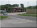


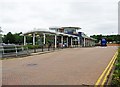

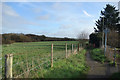
44 photos from this area
Area Information
Key information about the OX3 8LX including its size, population, and administrative classification.
- Area Type
- Postcode
- Area Size
- 1.1 hectares
- Population
- 1741
- Population Density
- 5518 people/km²
House Prices in OX3 8LX
40
Properties
£215,770
Average Sold Price
£99,000
Lowest Price
£381,000
Highest Price
Showing 40 properties
| Address | Type | Beds | Baths | Last Sale Price | Last Sale Date | |
|---|---|---|---|---|---|---|
| 149 Green Ridges, Oxford, OX3 8LX | Terraced | 2 | - | £325,000 | Jun 2025 | |
| 117 Green Ridges, Oxford, OX3 8LX | Maisonette | 2 | 1 | £255,000 | Apr 2025 | |
| 147 Green Ridges, Oxford, OX3 8LX | Terraced | 2 | 1 | £310,000 | May 2024 | |
| 103 Green Ridges, Oxford, OX3 8LX | Flat | 2 | 1 | £320,000 | Jan 2024 | |
| 101 Green Ridges, Oxford, OX3 8LX | Maisonette | 2 | 1 | £187,000 | Nov 2023 | |
| 137 Green Ridges, Oxford, OX3 8LX | house | - | - | £310,000 | Mar 2023 | |
| 157 Green Ridges, Oxford, OX3 8LX | house | - | - | £381,000 | Nov 2021 | |
| 111 Green Ridges, Oxford, OX3 8LX | Flat | - | - | £218,000 | Jun 2021 | |
| 145 Green Ridges, Oxford, OX3 8LX | Flat | - | - | £210,000 | Dec 2020 | |
| 151 Green Ridges, Oxford, OX3 8LX | Terraced | 2 | 2 | £280,000 | Aug 2020 |
Page 1 of 4
Energy Efficiency in OX3 8LX
Amenities
Schools
| Rank | School | Type | Entry gender | Ages |
|---|
Explore more schools in this area
Go to Schools tabDemographics
Household Size
Family (3-5 people)
most common
Accommodation Type
Houses
most common
Tenure
63
majority
Ethnic Group
White
most common
Religion
N/A
most common
Household Composition
N/A
most common
Age
47
median
Adults (30-64 years)
most common
Household Deprivation
N/A
with no deprivation
NS-SEC
46
in Lower managerial occupations
Explore more demographic insights in this area
Go to Demographics tabPlanning
Planning Constraints
- Flood RiskPremium
- Ramsar Wetland SitesPremium
- Area of Outstanding Natural BeautyPremium
- Protected Nature ReservePremium
- Protected WoodlandPremium