Area Overview for OX3 7JF
Photos of OX3 7JF
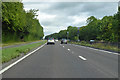
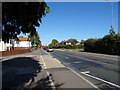
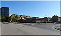
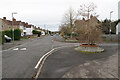
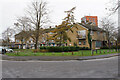
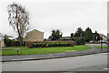
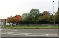
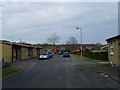
25 photos from this area
Area Information
Key information about the OX3 7JF including its size, population, and administrative classification.
- Area Type
- Postcode
- Area Size
- 6517 m²
- Population
- 2722
- Population Density
- 6992 people/km²
House Prices in OX3 7JF
9
Properties
£271,875
Average Sold Price
£142,500
Lowest Price
£350,000
Highest Price
Showing 9 properties
| Address | Type | Beds | Baths | Last Sale Price | Last Sale Date | |
|---|---|---|---|---|---|---|
| 228 Hollow Way, Oxford, OX3 7JF | Semi-detached | 3 | 1 | £325,000 | Feb 2020 | |
| 226 Hollow Way, Oxford, OX3 7JF | Semi-detached | 3 | 1 | £350,000 | Nov 2019 | |
| 236 Hollow Way, Oxford, OX3 7JF | house | - | - | £270,000 | Oct 2007 | |
| 230 Hollow Way, Oxford, OX3 7JF | house | 3 | - | £142,500 | Jun 2001 | |
| 234 Hollow Way, Oxford, OX3 7JF | house | - | - | - | - | |
| 232 Hollow Way, Oxford, OX3 7JF | house | - | - | - | - | |
| 238 Hollow Way, Oxford, OX3 7JF | Terraced | - | - | - | - | |
| St Francis Church Centre, St Francis Church Hall, Hollow Way, Oxford, OX3 7JF | commercial | - | - | - | - | |
| St Francis Church Playgroup, Hollow Way, Oxford, OX3 7JF | commercial | - | - | - | - |
Energy Efficiency in OX3 7JF
Amenities
Schools
| Rank | School | Type | Entry gender | Ages |
|---|
Explore more schools in this area
Go to Schools tabDemographics
Household Size
Family (3-5 people)
most common
Accommodation Type
Houses
most common
Tenure
41
majority
Ethnic Group
White
most common
Religion
N/A
most common
Household Composition
N/A
most common
Age
22
median
Young Adults (15-29 years)
most common
Household Deprivation
N/A
with no deprivation
NS-SEC
22
in Lower managerial occupations
Explore more demographic insights in this area
Go to Demographics tabPlanning
Planning Constraints
- Flood RiskPremium
- Ramsar Wetland SitesPremium
- Area of Outstanding Natural BeautyPremium
- Protected Nature ReservePremium
- Protected WoodlandPremium