Area Overview for OX3 0RU
Photos of OX3 0RU
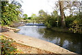
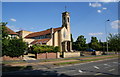
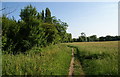
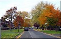
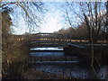
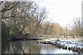
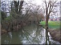
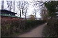
98 photos from this area
Area Information
Key information about the OX3 0RU including its size, population, and administrative classification.
- Area Type
- Postcode
- Area Size
- 1.2 hectares
- Population
- 1957
- Population Density
- 2700 people/km²
House Prices in OX3 0RU
20
Properties
£342,625
Average Sold Price
£110,000
Lowest Price
£480,000
Highest Price
Showing 20 properties
| Address | Type | Beds | Baths | Last Sale Price | Last Sale Date | |
|---|---|---|---|---|---|---|
| 48 Mortimer Drive, Oxford, OX3 0RU | Terraced | 3 | 1 | £477,000 | Aug 2025 | |
| 66 Mortimer Drive, Oxford, OX3 0RU | Terraced | 3 | 1 | £435,000 | Aug 2021 | |
| 56 Mortimer Drive, Oxford, OX3 0RU | Terraced | 3 | 1 | £375,000 | Nov 2020 | |
| 46 Mortimer Drive, Oxford, OX3 0RU | Terraced | 3 | 2 | £480,000 | Nov 2019 | |
| 60 Mortimer Drive, Oxford, OX3 0RU | Terraced | 3 | 1 | £417,000 | May 2018 | |
| 64 Mortimer Drive, Oxford, OX3 0RU | house | 3 | - | £245,000 | May 2013 | |
| 58 Mortimer Drive, Oxford, OX3 0RU | house | 4 | 1 | £202,000 | Apr 2012 | |
| 25 Mortimer Drive, Oxford, OX3 0RU | Terraced | - | - | £110,000 | Sep 1999 | |
| 54 Mortimer Drive, Oxford, OX3 0RU | Terraced | 4 | - | - | - | |
| 46A Mortimer Drive, Oxford, OX3 0RU | Terraced | 3 | - | - | - |
Page 1 of 2
Energy Efficiency in OX3 0RU
Amenities
Schools
| Rank | School | Type | Entry gender | Ages |
|---|
Explore more schools in this area
Go to Schools tabDemographics
Household Size
Family (3-5 people)
most common
Accommodation Type
Houses
most common
Tenure
49
majority
Ethnic Group
White
most common
Religion
N/A
most common
Household Composition
N/A
most common
Age
47
median
Adults (30-64 years)
most common
Household Deprivation
N/A
with no deprivation
NS-SEC
36
in Lower managerial occupations
Explore more demographic insights in this area
Go to Demographics tabPlanning
Planning Constraints
- Flood RiskPremium
- Ramsar Wetland SitesPremium
- Area of Outstanding Natural BeautyPremium
- Protected Nature ReservePremium
- Protected WoodlandPremium