Area Overview for OX29 9UW
Photos of OX29 9UW
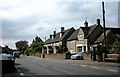
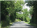
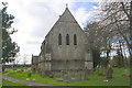
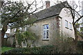
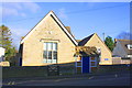
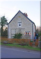

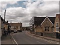
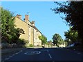
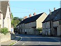
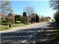
25 photos from this area
Area Information
Key information about the OX29 9UW including its size, population, and administrative classification.
- Area Type
- Postcode
- Area Size
- 20.2 hectares
- Population
- 1108
- Population Density
- 81 people/km²
House Prices in OX29 9UW
25
Properties
£678,571
Average Sold Price
£215,000
Lowest Price
£1,500,000
Highest Price
Showing 25 properties
| Address | Type | Beds | Baths | Last Sale Price | Last Sale Date | |
|---|---|---|---|---|---|---|
| Wayside House, Poffley End, Hailey, OX29 9UW | house | - | - | £1,185,000 | Oct 2021 | |
| The Old Manor, Poffley End, Hailey, OX29 9UW | Detached | 6 | 4 | £1,500,000 | May 2018 | |
| Cornerways, Poffley End, Hailey, OX29 9UW | Flat | 4 | 2 | £430,000 | Aug 2011 | |
| Blenheim Cottage, Poffley End, Hailey, OX29 9UW | house | - | - | £640,000 | Dec 2009 | |
| Springdale, Poffley End, Hailey, OX29 9UW | Detached | - | - | £430,000 | Aug 2007 | |
| Woodlawn, Poffley End, Hailey, OX29 9UW | Detached | - | - | £350,000 | Apr 2005 | |
| Swanhall Cottage, Poffley End, Hailey, OX29 9UW | Semi-detached | 4 | - | £215,000 | Nov 1998 | |
| Winnings Farmhouse, Poffley End, Hailey, OX29 9UW | Detached | 3 | 3 | - | - | |
| 3, Orchard View, Bushey Close Cottages, Poffley End, Hailey, OX29 9UW | Detached | 6 | 4 | - | - | |
| Elmwood Nursery, Poffley End, Hailey, OX29 9UW | Detached | 7 | 4 | - | - |
Page 1 of 3
Energy Efficiency in OX29 9UW
Amenities
Schools
| Rank | School | Type | Entry gender | Ages |
|---|
Explore more schools in this area
Go to Schools tabDemographics
Household Size
Two person
most common
Accommodation Type
Houses
most common
Tenure
82
majority
Ethnic Group
White
most common
Religion
N/A
most common
Household Composition
N/A
most common
Age
47
median
Adults (30-64 years)
most common
Household Deprivation
N/A
with no deprivation
NS-SEC
45
in Lower managerial occupations
Explore more demographic insights in this area
Go to Demographics tabPlanning
Planning Constraints
- Flood RiskPremium
- Ramsar Wetland SitesPremium
- Area of Outstanding Natural BeautyPremium
- Protected Nature ReservePremium
- Protected WoodlandPremium