Area Overview for OX29 9TR
Photos of OX29 9TR
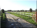
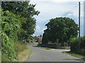
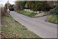
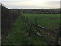
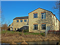
10 photos from this area
Area Information
Key information about the OX29 9TR including its size, population, and administrative classification.
- Area Type
- Postcode
- Area Size
- 8.1 hectares
- Population
- 1580
- Population Density
- 97 people/km²
House Prices in OX29 9TR
10
Properties
£463,333
Average Sold Price
£325,000
Lowest Price
£575,000
Highest Price
Showing 10 properties
| Address | Type | Beds | Baths | Last Sale Price | Last Sale Date | |
|---|---|---|---|---|---|---|
| Kencroft, Street Through Crawley, Crawley, Witney, OX29 9TR | house | - | - | £575,000 | Jun 2016 | |
| Wayside, Foxburrow Lane, Crawley, Witney, OX29 9TR | Cottage | 3 | 2 | £490,000 | Jul 2015 | |
| Willow Tree Cottage, Street Through Crawley, Crawley, Witney, OX29 9TR | house | 3 | - | £325,000 | Oct 2010 | |
| The Cottage, Street Through Crawley, Crawley, Witney, OX29 9TR | Cottage | 3 | 1 | - | - | |
| Printers Barn, Foxburrow Lane, Crawley, Witney, OX29 9TR | Cottage | 3 | 1 | - | - | |
| Five Ways Cottage, Street Through Crawley, Crawley, Witney, OX29 9TR | Detached | - | - | - | - | |
| Brookbank, Street Through Crawley, Crawley, Witney, OX29 9TR | Semi-detached | - | - | - | - | |
| The Farm House, Street Through Crawley, Crawley, Witney, OX29 9TR | house | - | - | - | - | |
| Showell Barn, Street Through Crawley, Crawley, Witney, OX29 9TR | Detached | - | - | - | - | |
| Annexe, The Farm House, Street Through Crawley, Crawley, Witney, OX29 9TR | Detached | - | - | - | - |
Energy Efficiency in OX29 9TR
Amenities
Schools
| Rank | School | Type | Entry gender | Ages |
|---|
Explore more schools in this area
Go to Schools tabDemographics
Household Size
Two person
most common
Accommodation Type
Houses
most common
Tenure
76
majority
Ethnic Group
White
most common
Religion
N/A
most common
Household Composition
N/A
most common
Age
47
median
Adults (30-64 years)
most common
Household Deprivation
N/A
with no deprivation
NS-SEC
40
in Lower managerial occupations
Explore more demographic insights in this area
Go to Demographics tabPlanning
Planning Constraints
- Flood RiskPremium
- Ramsar Wetland SitesPremium
- Area of Outstanding Natural BeautyPremium
- Protected Nature ReservePremium
- Protected WoodlandPremium