Area Overview for OX29 8PR
Photos of OX29 8PR
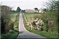
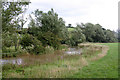
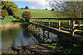
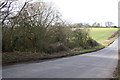
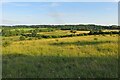
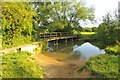
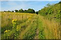
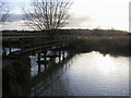
21 photos from this area
Area Information
Key information about the OX29 8PR including its size, population, and administrative classification.
- Area Type
- Postcode
- Area Size
- 34.2 hectares
- Population
- 1435
- Population Density
- 236 people/km²
House Prices in OX29 8PR
10
Properties
£482,563
Average Sold Price
£212,500
Lowest Price
£850,000
Highest Price
Showing 10 properties
| Address | Type | Beds | Baths | Last Sale Price | Last Sale Date | |
|---|---|---|---|---|---|---|
| Evenlode Edge, 7 Brook Lane, Stonesfield, OX29 8PR | Bungalow | 4 | 3 | £850,000 | Feb 2018 | |
| Plater Lodge, 2 Brook Lane, Stonesfield, OX29 8PR | Detached | 5 | 2 | £570,000 | Sep 2017 | |
| 6 Brook Lane, Stonesfield, OX29 8PR | Bungalow | 5 | - | £475,000 | Sep 2015 | |
| Brook House, Brook Lane, Stonesfield, OX29 8PR | house | - | - | £683,000 | Dec 2011 | |
| 4 Brook Lane, Stonesfield, OX29 8PR | Detached | - | - | £410,000 | May 2006 | |
| Peirraille, 5 Brook Lane, Stonesfield, OX29 8PR | Detached | - | - | £340,000 | Sep 2004 | |
| Wellspring, Brook Lane, Stonesfield, OX29 8PR | Detached | - | - | £320,000 | May 2004 | |
| Brooklands, Brook Lane, Stonesfield, OX29 8PR | Bungalow | - | - | £212,500 | Feb 2001 | |
| The Flat, 4 Brook Lane, Stonesfield, OX29 8PR | Flat | - | - | - | - | |
| The Rectory, Brook Lane, Stonesfield, OX29 8PR | house | - | - | - | - |
Energy Efficiency in OX29 8PR
Amenities
Schools
| Rank | School | Type | Entry gender | Ages |
|---|
Explore more schools in this area
Go to Schools tabDemographics
Household Size
Two person
most common
Accommodation Type
Houses
most common
Tenure
77
majority
Ethnic Group
White
most common
Religion
N/A
most common
Household Composition
N/A
most common
Age
47
median
Adults (30-64 years)
most common
Household Deprivation
N/A
with no deprivation
NS-SEC
49
in Lower managerial occupations
Explore more demographic insights in this area
Go to Demographics tabPlanning
Planning Constraints
- Flood RiskPremium
- Ramsar Wetland SitesPremium
- Area of Outstanding Natural BeautyPremium
- Protected Nature ReservePremium
- Protected WoodlandPremium