Area Overview for OX29 8JU
Photos of OX29 8JU
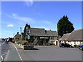
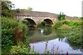
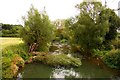
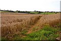

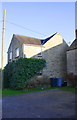
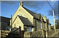
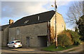
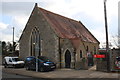


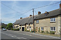
77 photos from this area
Area Information
Key information about the OX29 8JU including its size, population, and administrative classification.
- Area Type
- Postcode
- Area Size
- 17.2 hectares
- Population
- 1883
- Population Density
- 596 people/km²
House Prices in OX29 8JU
16
Properties
£410,303
Average Sold Price
£45,000
Lowest Price
£798,000
Highest Price
Showing 16 properties
| Address | Type | Beds | Baths | Last Sale Price | Last Sale Date | |
|---|---|---|---|---|---|---|
| Flagstones, Park Lane, Long Hanborough, OX29 8JU | house | - | - | £550,000 | Jun 2021 | |
| High Thatch, Park Lane, Long Hanborough, OX29 8JU | Detached | 4 | 2 | £650,000 | May 2021 | |
| Florence Cottage, 1 Park Lane, Long Hanborough, OX29 8JU | Terraced | 3 | - | £620,026 | Feb 2020 | |
| Park House, Park Lane, Long Hanborough, OX29 8JU | house | - | - | £798,000 | Nov 2017 | |
| Rose Cottage, Park Lane, Long Hanborough, OX29 8JU | Semi-detached | - | - | £490,000 | Oct 2007 | |
| Tretawn, Park Lane, Long Hanborough, OX29 8JU | house | - | - | £495,000 | Jun 2004 | |
| 3 Park Lane, Long Hanborough, OX29 8JU | Terraced | - | - | £195,000 | Sep 2001 | |
| Wayside, Park Lane, Long Hanborough, OX29 8JU | Semi-detached | - | - | £45,000 | Oct 2000 | |
| Little Holme, Park Lane, Long Hanborough, OX29 8JU | Semi-detached | - | - | £175,000 | Sep 1998 | |
| 2 Park Lane, Long Hanborough, OX29 8JU | Land | 4 | - | £85,000 | Jul 1997 |
Page 1 of 2
Energy Efficiency in OX29 8JU
Amenities
Schools
| Rank | School | Type | Entry gender | Ages |
|---|
Explore more schools in this area
Go to Schools tabDemographics
Household Size
Two person
most common
Accommodation Type
Houses
most common
Tenure
75
majority
Ethnic Group
White
most common
Religion
N/A
most common
Household Composition
N/A
most common
Age
47
median
Adults (30-64 years)
most common
Household Deprivation
N/A
with no deprivation
NS-SEC
45
in Lower managerial occupations
Explore more demographic insights in this area
Go to Demographics tabPlanning
Planning Constraints
- Flood RiskPremium
- Ramsar Wetland SitesPremium
- Area of Outstanding Natural BeautyPremium
- Protected Nature ReservePremium
- Protected WoodlandPremium