Area Overview for OX29 8JQ
Photos of OX29 8JQ
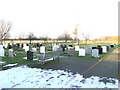
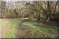
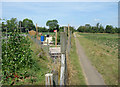
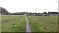
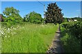

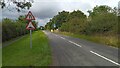
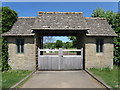

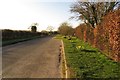
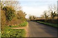
15 photos from this area
Area Information
Key information about the OX29 8JQ including its size, population, and administrative classification.
- Area Type
- Postcode
- Area Size
- 3.4 hectares
- Population
- 1618
- Population Density
- 300 people/km²
House Prices in OX29 8JQ
61
Properties
£255,294
Average Sold Price
£55,000
Lowest Price
£415,000
Highest Price
Showing 61 properties
| Address | Type | Beds | Baths | Last Sale Price | Last Sale Date | |
|---|---|---|---|---|---|---|
| 60 Pinsley Road, Long Hanborough, OX29 8JQ | Terraced | 3 | 2 | £415,000 | Aug 2025 | |
| 11 Pinsley Road, Long Hanborough, OX29 8JQ | Terraced | 2 | 1 | £324,000 | Mar 2025 | |
| 19 Pinsley Road, Long Hanborough, OX29 8JQ | Terraced | 3 | 1 | £380,000 | Jul 2024 | |
| 27 Pinsley Road, Long Hanborough, OX29 8JQ | Terraced | 2 | 1 | £307,000 | Mar 2024 | |
| 46 Pinsley Road, Long Hanborough, OX29 8JQ | Terraced | 4 | - | £350,000 | Aug 2021 | |
| 54 Pinsley Road, Long Hanborough, OX29 8JQ | house | - | - | £298,000 | Sep 2019 | |
| 24 Pinsley Road, Long Hanborough, OX29 8JQ | house | - | - | £360,000 | Oct 2016 | |
| 43 Pinsley Road, Long Hanborough, OX29 8JQ | Terraced | 3 | 1 | £318,500 | Sep 2016 | |
| 3 Pinsley Road, Long Hanborough, OX29 8JQ | Bungalow | 3 | 1 | £279,000 | Apr 2016 | |
| 19A Pinsley Road, Long Hanborough, OX29 8JQ | Semi-detached | 4 | 2 | £295,000 | Nov 2015 |
Page 1 of 7
Energy Efficiency in OX29 8JQ
Amenities
Schools
| Rank | School | Type | Entry gender | Ages |
|---|
Explore more schools in this area
Go to Schools tabDemographics
Household Size
Family (3-5 people)
most common
Accommodation Type
Houses
most common
Tenure
72
majority
Ethnic Group
White
most common
Religion
N/A
most common
Household Composition
N/A
most common
Age
47
median
Adults (30-64 years)
most common
Household Deprivation
N/A
with no deprivation
NS-SEC
43
in Lower managerial occupations
Explore more demographic insights in this area
Go to Demographics tabPlanning
Planning Constraints
- Flood RiskPremium
- Ramsar Wetland SitesPremium
- Area of Outstanding Natural BeautyPremium
- Protected Nature ReservePremium
- Protected WoodlandPremium