Area Overview for OX29 8HJ
Photos of OX29 8HJ
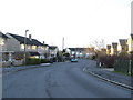
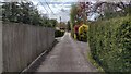
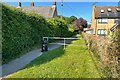
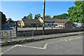
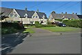

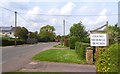
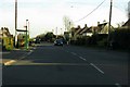
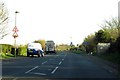
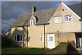
10 photos from this area
Area Information
Key information about the OX29 8HJ including its size, population, and administrative classification.
- Area Type
- Postcode
- Area Size
- 9.6 hectares
- Population
- 1521
- Population Density
- 359 people/km²
House Prices in OX29 8HJ
27
Properties
£478,833
Average Sold Price
£248,000
Lowest Price
£885,000
Highest Price
Showing 27 properties
| Address | Type | Beds | Baths | Last Sale Price | Last Sale Date | |
|---|---|---|---|---|---|---|
| 13 Wroslyn Road, Freeland, OX29 8HJ | Detached | 4 | 3 | £885,000 | Aug 2025 | |
| 21 Wroslyn Road, Freeland, OX29 8HJ | Bungalow | 3 | 1 | £470,000 | Feb 2025 | |
| 7 Wroslyn Road, Freeland, OX29 8HJ | Bungalow | - | - | £530,000 | Jun 2024 | |
| Wychwood, 9 Wroslyn Road, Freeland, OX29 8HJ | Detached | 4 | 3 | £745,000 | Dec 2022 | |
| 5 Wroslyn Road, Freeland, OX29 8HJ | Bungalow | 4 | 2 | £625,001 | Mar 2021 | |
| Chalfont, 3 Wroslyn Road, Freeland, OX29 8HJ | Bungalow | - | - | £335,000 | Dec 2018 | |
| 33 Wroslyn Road, Freeland, OX29 8HJ | Cottage | 3 | 2 | £305,000 | Jun 2016 | |
| 31 Wroslyn Road, Freeland, OX29 8HJ | Detached | 3 | - | £405,000 | Dec 2014 | |
| 11 Wroslyn Road, Freeland, OX29 8HJ | Detached | - | - | £517,000 | Apr 2010 | |
| Hollycrest, 43 Wroslyn Road, Freeland, OX29 8HJ | Detached | - | - | £425,000 | Feb 2008 |
Page 1 of 3
Energy Efficiency in OX29 8HJ
Amenities
Schools
| Rank | School | Type | Entry gender | Ages |
|---|
Explore more schools in this area
Go to Schools tabDemographics
Household Size
Two person
most common
Accommodation Type
Houses
most common
Tenure
89
majority
Ethnic Group
White
most common
Religion
N/A
most common
Household Composition
N/A
most common
Age
47
median
Adults (30-64 years)
most common
Household Deprivation
N/A
with no deprivation
NS-SEC
48
in Lower managerial occupations
Explore more demographic insights in this area
Go to Demographics tabPlanning
Planning Constraints
- Flood RiskPremium
- Ramsar Wetland SitesPremium
- Area of Outstanding Natural BeautyPremium
- Protected Nature ReservePremium
- Protected WoodlandPremium