Area Overview for OX29 8DY
Photos of OX29 8DY
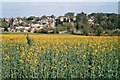
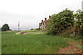
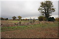
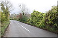
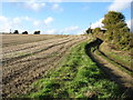
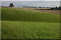
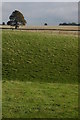
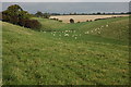
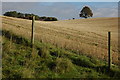
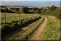
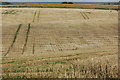
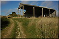
18 photos from this area
Area Information
Key information about the OX29 8DY including its size, population, and administrative classification.
- Area Type
- Postcode
- Area Size
- 4.5 hectares
- Population
- 1435
- Population Density
- 236 people/km²
House Prices in OX29 8DY
14
Properties
£416,056
Average Sold Price
£212,000
Lowest Price
£610,000
Highest Price
Showing 14 properties
| Address | Type | Beds | Baths | Last Sale Price | Last Sale Date | |
|---|---|---|---|---|---|---|
| The Cottage, Laughton Hill, Stonesfield, OX29 8DY | Cottage | 1 | 1 | £289,950 | Jun 2021 | |
| Windrush Cottage, Laughton Hill, Stonesfield, OX29 8DY | Cottage | 3 | 1 | £471,500 | Jun 2016 | |
| Clockcase, Laughton Hill, Stonesfield, OX29 8DY | Detached | - | - | £610,000 | Sep 2015 | |
| New Haven, Laughton Hill, Stonesfield, OX29 8DY | Cottage | 4 | 2 | £450,000 | Jun 2013 | |
| Dene Edge, Laughton Hill, Stonesfield, OX29 8DY | Semi-detached | 4 | 2 | £590,000 | May 2013 | |
| Crook Cottage, Laughton Hill, Stonesfield, OX29 8DY | house | 4 | - | £395,000 | Oct 2011 | |
| Little Redwood, Laughton Hill, Stonesfield, OX29 8DY | Semi-detached | 2 | 1 | £212,000 | Sep 2009 | |
| Waterloo Barn, Laughton Hill, Stonesfield, OX29 8DY | Bungalow | 5 | - | £310,000 | Jun 1997 | |
| Annexe, Red Gate Cottage, Laughton Hill, Stonesfield, OX29 8DY | Flat | - | - | - | - | |
| Studio, Waterloo Barn, Laughton Hill, Stonesfield, OX29 8DY | Flat | - | - | - | - |
Page 1 of 2
Energy Efficiency in OX29 8DY
Amenities
Schools
| Rank | School | Type | Entry gender | Ages |
|---|
Explore more schools in this area
Go to Schools tabDemographics
Household Size
Two person
most common
Accommodation Type
Houses
most common
Tenure
77
majority
Ethnic Group
White
most common
Religion
N/A
most common
Household Composition
N/A
most common
Age
47
median
Adults (30-64 years)
most common
Household Deprivation
N/A
with no deprivation
NS-SEC
49
in Lower managerial occupations
Explore more demographic insights in this area
Go to Demographics tabPlanning
Planning Constraints
- Flood RiskPremium
- Ramsar Wetland SitesPremium
- Area of Outstanding Natural BeautyPremium
- Protected Nature ReservePremium
- Protected WoodlandPremium