Area Overview for OX29 8DH
Photos of OX29 8DH
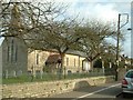
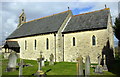
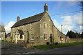
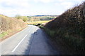
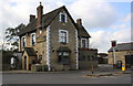
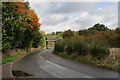
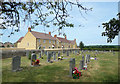
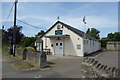
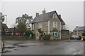
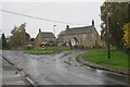
77 photos from this area
Area Information
Key information about the OX29 8DH including its size, population, and administrative classification.
- Area Type
- Postcode
- Area Size
- 2.0 hectares
- Population
- 1883
- Population Density
- 596 people/km²
House Prices in OX29 8DH
33
Properties
£337,674
Average Sold Price
£97,000
Lowest Price
£500,000
Highest Price
Showing 33 properties
| Address | Type | Beds | Baths | Last Sale Price | Last Sale Date | |
|---|---|---|---|---|---|---|
| 36 Hurdeswell, Long Hanborough, OX29 8DH | Detached | 3 | 1 | £460,000 | Nov 2024 | |
| 8 Hurdeswell, Long Hanborough, OX29 8DH | house | 4 | 2 | £500,000 | Feb 2022 | |
| 4 Hurdeswell, Long Hanborough, OX29 8DH | Detached | 4 | 1 | £430,000 | Feb 2020 | |
| 24 Hurdeswell, Long Hanborough, OX29 8DH | Detached | 4 | 1 | £360,000 | Aug 2019 | |
| 58 Hurdeswell, Long Hanborough, OX29 8DH | Bungalow | 3 | 1 | £425,000 | Sep 2016 | |
| 34 Hurdeswell, Long Hanborough, OX29 8DH | Detached | 4 | - | £405,000 | Feb 2014 | |
| 44 Hurdeswell, Long Hanborough, OX29 8DH | Detached | 3 | 1 | £335,000 | Jun 2013 | |
| 54 Hurdeswell, Long Hanborough, OX29 8DH | house | 3 | - | £277,000 | Oct 2012 | |
| 62 Hurdeswell, Long Hanborough, OX29 8DH | Bungalow | 3 | - | £283,000 | Sep 2012 | |
| 38 Hurdeswell, Long Hanborough, OX29 8DH | Detached | 4 | - | £365,000 | Jul 2012 |
Page 1 of 4
Energy Efficiency in OX29 8DH
Amenities
Schools
| Rank | School | Type | Entry gender | Ages |
|---|
Explore more schools in this area
Go to Schools tabDemographics
Household Size
Two person
most common
Accommodation Type
Houses
most common
Tenure
75
majority
Ethnic Group
White
most common
Religion
N/A
most common
Household Composition
N/A
most common
Age
47
median
Adults (30-64 years)
most common
Household Deprivation
N/A
with no deprivation
NS-SEC
45
in Lower managerial occupations
Explore more demographic insights in this area
Go to Demographics tabPlanning
Planning Constraints
- Flood RiskPremium
- Ramsar Wetland SitesPremium
- Area of Outstanding Natural BeautyPremium
- Protected Nature ReservePremium
- Protected WoodlandPremium