Area Overview for OX29 7XR
Photos of OX29 7XR

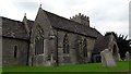
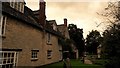
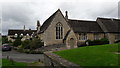
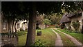
69 photos from this area
Area Information
Key information about the OX29 7XR including its size, population, and administrative classification.
- Area Type
- Postcode
- Area Size
- 5760 m²
- Population
- 2420
- Population Density
- 116 people/km²
House Prices in OX29 7XR
13
Properties
£240,600
Average Sold Price
£113,500
Lowest Price
£485,000
Highest Price
Showing 13 properties
| Address | Type | Beds | Baths | Last Sale Price | Last Sale Date | |
|---|---|---|---|---|---|---|
| 30 Starnham Road, Ducklington, Witney, OX29 7XR | Semi-detached | 2 | 1 | £282,500 | May 2023 | |
| Furlough House, 32 Starnham Road, Ducklington, Witney, OX29 7XR | Detached | 3 | 2 | £485,000 | Mar 2021 | |
| 22 Starnham Road, Ducklington, Witney, OX29 7XR | Terraced | - | - | £197,000 | Jun 2006 | |
| 12 Starnham Road, Ducklington, Witney, OX29 7XR | Terraced | - | - | £113,500 | Jul 2005 | |
| 14 Starnham Road, Ducklington, Witney, OX29 7XR | Terraced | - | - | £125,000 | Nov 2002 | |
| 18 Starnham Road, Ducklington, Witney, OX29 7XR | Terraced | - | - | - | - | |
| 16 Starnham Road, Ducklington, Witney, OX29 7XR | house | - | - | - | - | |
| 20 Starnham Road, Ducklington, Witney, OX29 7XR | Terraced | - | - | - | - | |
| 26 Starnham Road, Ducklington, Witney, OX29 7XR | Bungalow | - | - | - | - | |
| 10 Starnham Road, Ducklington, Witney, OX29 7XR | Bungalow | - | - | - | - |
Page 1 of 2
Energy Efficiency in OX29 7XR
Amenities
Schools
| Rank | School | Type | Entry gender | Ages |
|---|
Explore more schools in this area
Go to Schools tabDemographics
Household Size
Two person
most common
Accommodation Type
Houses
most common
Tenure
74
majority
Ethnic Group
White
most common
Religion
N/A
most common
Household Composition
N/A
most common
Age
47
median
Adults (30-64 years)
most common
Household Deprivation
N/A
with no deprivation
NS-SEC
39
in Lower managerial occupations
Explore more demographic insights in this area
Go to Demographics tabPlanning
Planning Constraints
- Flood RiskPremium
- Ramsar Wetland SitesPremium
- Area of Outstanding Natural BeautyPremium
- Protected Nature ReservePremium
- Protected WoodlandPremium