Area Overview for OX29 7UG
Photos of OX29 7UG


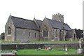
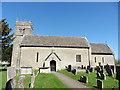


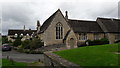
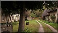

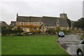

69 photos from this area
Area Information
Key information about the OX29 7UG including its size, population, and administrative classification.
- Area Type
- Postcode
- Area Size
- 1.1 hectares
- Population
- 2420
- Population Density
- 116 people/km²
House Prices in OX29 7UG
20
Properties
£302,917
Average Sold Price
£100,000
Lowest Price
£457,500
Highest Price
Showing 20 properties
| Address | Type | Beds | Baths | Last Sale Price | Last Sale Date | |
|---|---|---|---|---|---|---|
| 10 Church Street, Ducklington, Witney, OX29 7UG | house | 2 | 1 | £310,000 | Nov 2021 | |
| 10 Church Street, Ducklington, Witney, OX29 7UG | Detached | - | - | £310,000 | Nov 2021 | |
| 2A Church Street, Ducklington, Witney, OX29 7UG | Detached | 1 | 1 | £369,500 | Dec 2018 | |
| 12 Church Street, Ducklington, Witney, OX29 7UG | Cottage | 2 | - | £350,000 | May 2018 | |
| Rose Cottage, 14 Church Street, Ducklington, Witney, OX29 7UG | Cottage | 4 | 1 | £457,500 | Nov 2017 | |
| 20 Church Street, Ducklington, Witney, OX29 7UG | Semi-detached | 2 | - | £275,000 | Aug 2013 | |
| Old School Place, 18 Church Street, Ducklington, Witney, OX29 7UG | Cottage | 3 | 2 | £340,000 | Jun 2013 | |
| 16A Church Street, Ducklington, Witney, OX29 7UG | house | - | - | £397,500 | Aug 2011 | |
| 6 Church Street, Ducklington, Witney, OX29 7UG | Semi-detached | - | - | £270,000 | Jun 2005 | |
| 28 Church Street, Ducklington, Witney, OX29 7UG | Semi-detached | - | - | £205,500 | Jul 2003 |
Page 1 of 2
Energy Efficiency in OX29 7UG
Amenities
Schools
| Rank | School | Type | Entry gender | Ages |
|---|
Explore more schools in this area
Go to Schools tabDemographics
Household Size
Two person
most common
Accommodation Type
Houses
most common
Tenure
74
majority
Ethnic Group
White
most common
Religion
N/A
most common
Household Composition
N/A
most common
Age
47
median
Adults (30-64 years)
most common
Household Deprivation
N/A
with no deprivation
NS-SEC
39
in Lower managerial occupations
Explore more demographic insights in this area
Go to Demographics tabPlanning
Planning Constraints
- Flood RiskPremium
- Ramsar Wetland SitesPremium
- Area of Outstanding Natural BeautyPremium
- Protected Nature ReservePremium
- Protected WoodlandPremium