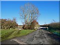
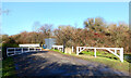
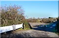
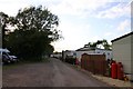
Area Overview for OX29 7RD
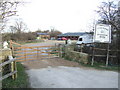
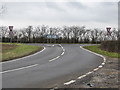
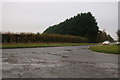
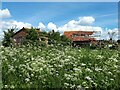
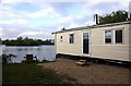
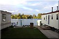
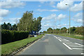
Photos of OX29 7RD

Area Information
Living in OX29 7RD offers a quiet residential experience within a specific, tightly defined cluster. This postcode covers just 2.4 hectares, creating a very concentrated neighbourhood where residents live close to one another. The population stands at 1608 people, resulting in a population density of 106 people per square kilometre. This figure indicates a settled community without the congestion found in larger urban zones. Daily life here is characterised by a small-scale environment where the layout supports a contained, localised way of living. You will find that the area functions as a self-contained residential pocket. The geography restricts sprawl, meaning most residents rely on immediate surroundings for their needs or commute further out for work. The small size of the postcode means you gain a clear sense of the local landscape and boundaries. There is no ambiguity about what constitutes the area; it is exactly what the address describes. This precision is valuable when considering the exact footprint of your potential home. The environment is straightforward, focusing on habitation rather than complex mixed-use developments. When you move here, you enter an established setting with clear dimensions. The area does not expand indefinitely; it remains a distinct cluster of homes. This stability appeals to buyers who prefer predictability over rapid urban change. You gain a specific territory with a defined population and clear physical limits. The combination of low density and clear boundaries creates a manageable living space for those seeking a home away from the chaos of major towns.
- Area Type
- Postcode
- Area Size
- 2.4 hectares
- Population
- 1608
- Population Density
- 106 people/km²
The property market in OX29 7RD is heavily skewed towards ownership. Home ownership reaches 85%, making this one of the most owner-occupied postcodes in the record. This statistic tells a clear story about the local housing market. You are looking at a zone dominated by families and individuals rather than landlords and private lodgers. The high percentage of owners means rental yields are unlikely to be the primary driver of the market here. Accommodation types are strictly limited to houses. The data records no flats or top-floor apartments within this 2.4 hectare area. If you wish to buy a bungalow, a detached home, or a semi-detached property, you are within the realm of possibility. However, the inventory excludes the urban density of flats that some buyers seek. This restriction aligns with the high self-ownership rate, as people typically need larger spaces to secure mortgages and build equity in this size of area. For buyers considering OX29 7RD, the implications are direct. You deal with a market of freeholders and leaseholders, not monthly tenancy agreements. The housing stock reflects a desire for ground-floor access and private gardens, features common in house-based living. The small size of the postcode concentrates these properties, meaning supply is fixed by the land boundaries. You cannot expect new developments to expand the borough significantly within this specific address. Your options exist within the existing framework of houses that have stood for generations or were built to replace them.
House Prices in OX29 7RD
No properties found in this postcode.
Energy Efficiency in OX29 7RD
Your lifestyle in OX29 7RD revolves around practical, accessible amenities within easy reach. Five retail outlets sit within practical reach of your home. You have access to Lidl New, Waitrose Little, and Tesco Witney as notable shopping options. These supermarkets provide the essential groceries you need for daily cooking and household stocking. The presence of Waitrose and Tesco suggests a level of quality and variety that elevates the standard of local shopping. You do not need to travel deep into the city centre for basic provisions. These five retail points serve the entire population of 1608 residents in the postcode. They form the backbone of your commercial life. While the area is residential, these shops ensure you can handle your shopping needs without significant travel. The convenience of having major chains nearby adds value to the property location. Dining options are likely integrated with these retail parks, though specific restaurants are not detailed in the current data. You will find that the retail environment is functional and reliable. The distance to these amenities is short enough to add them to your daily routine. Walking or a short drive gets you from your home to your shopping basket. This integration of retail and residential space creates a comfortable rhythm for daily life. You can plan your errands efficiently, knowing exactly where the shops are. The amenities listed ensure that you are well-serviced despite the small scale of the neighbourhood.
Amenities
Schools
Families settling in OX29 7RD have access to specific educational institutions nearby. The nearest primary education provider is Standlake Church of England Primary School. This school holds a Ofsted rating of good, providing a solid foundation for young learners. It serves the immediate residential needs of children within the catchment. For children with special educational needs, the Mulberry Bush School is located in the vicinity. This institution caters to a different demographic, offering specialist support where main-stream education requires additional intervention. The mix of schools reflects the age profile of the local population. With adults mostly aged 30 to 64, these families require reliable schooling options. The presence of a primary school with a good rating ensures that younger children have a stable educational path close to home. While the data does not list secondary schools, the availability of primary and special education indicates that the infrastructure supports early and special needs learning directly. You do not need to travel far for these specific stages of education. However, you should note that the data does not provide Ofsted ratings for all listed institutions. Standlake Church of England Primary School is the only one with a recorded rating in the current dataset. You must verify other requirements separately if specific secondary or special needs criteria apply beyond what is listed. The proximity of these schools means that daily commute times for drop-offs will be short. This convenience is a practical factor when weighing the decision to buy a home in OX29 7RD.
| Rank | School | Type | Entry gender | Ages |
|---|
Explore more schools in this area
Go to Schools tabDemographics
The community in OX29 7RD is defined by a mature demographic profile. The median age is 47, which places the resident profile squarely in the middle adulthood bracket. Most commonly, the population consists of adults aged between 30 and 64 years. This age range dominates the neighbourhood, suggesting a population that has likely settled in the area and established long-term roots. You will find fewer families with very young children compared to other zones, but also fewer retirees than you might see in older village centres. Home ownership is the defining feature of this locality, with 85% of households owning their property outright or with a mortgage. This high rate signals a community of stability rather than transient tenants. The accommodation type is exclusively houses, which fits the high home ownership rate perfectly. There are no flats or apartments in this specific postcode sector. The dominant ethnic group is White, reflecting a traditional composition typical of many established English residential zones. Deprivation is not a factor recorded for this specific area in the available figures. The data presents a clean slate regarding economic disparity, implying a relatively uniform economic standing among residents. The concentration of home owners suggests a neighbourhood where people have invested in their local environment. This demographic consistency means you can expect a community bound by shared living standards and property tenure. The age structure further reinforces a settled atmosphere, where residents are likely to vote with their feet and remain in the area for the foreseeable future.
Household Size
Accommodation Type
Tenure
Ethnic Group
Religion
Household Composition
Age
Household Deprivation
NS-SEC
Explore more demographic insights in this area
Go to Demographics tabPlanning
Planning Constraints
- Flood RiskPremium
- Ramsar Wetland SitesPremium
- Area of Outstanding Natural BeautyPremium
- Protected Nature ReservePremium
- Protected WoodlandPremium